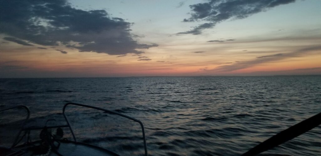
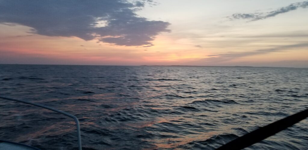
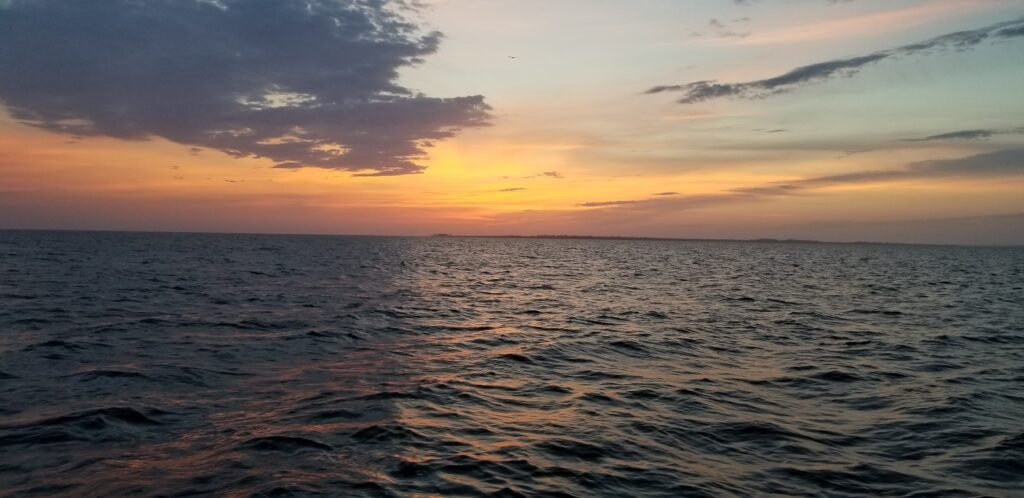
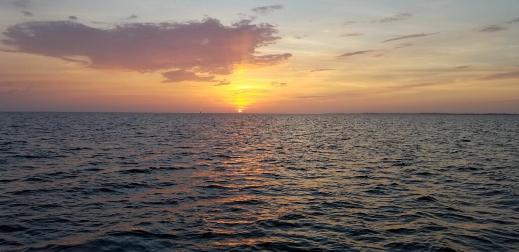
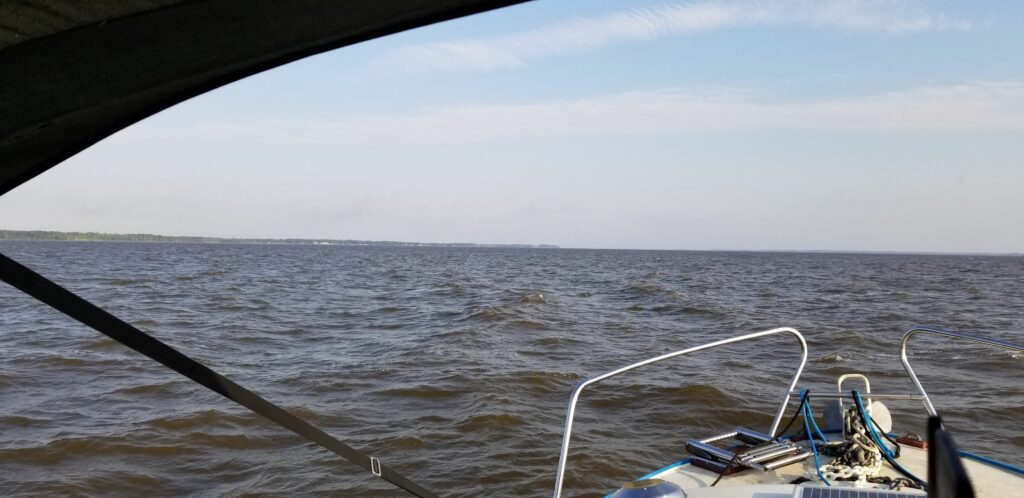
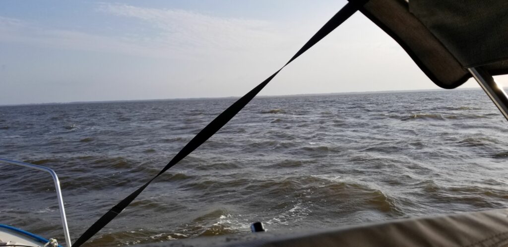
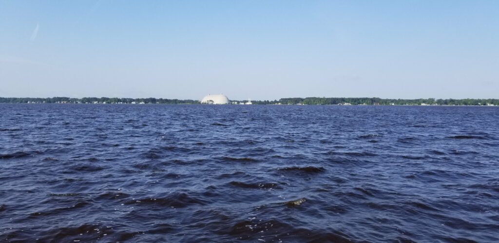
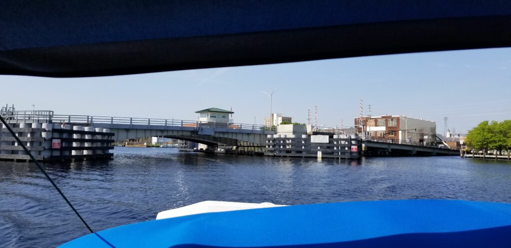
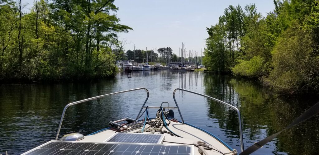
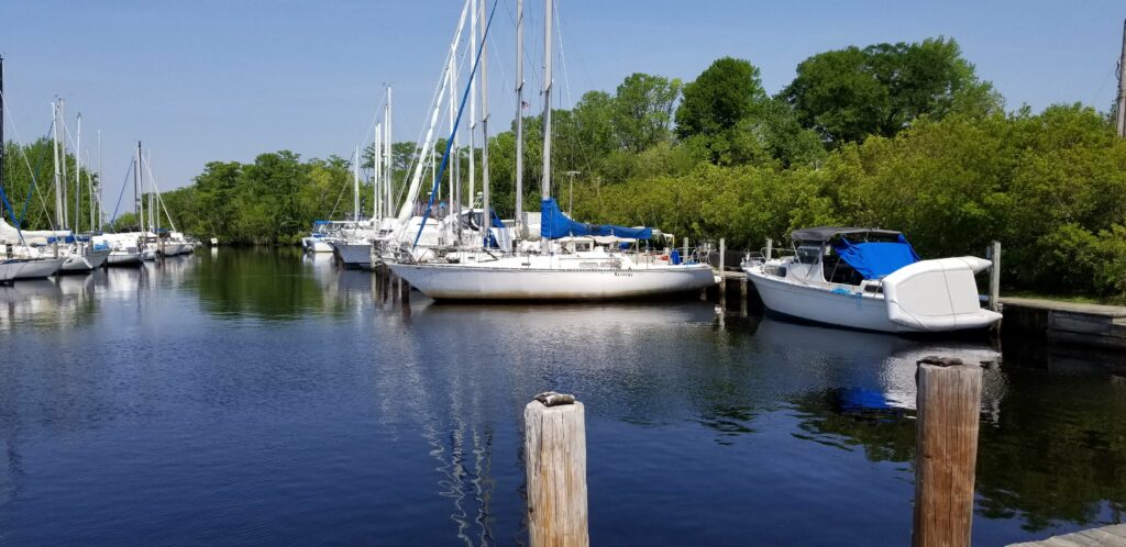
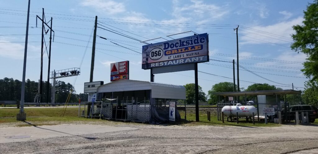
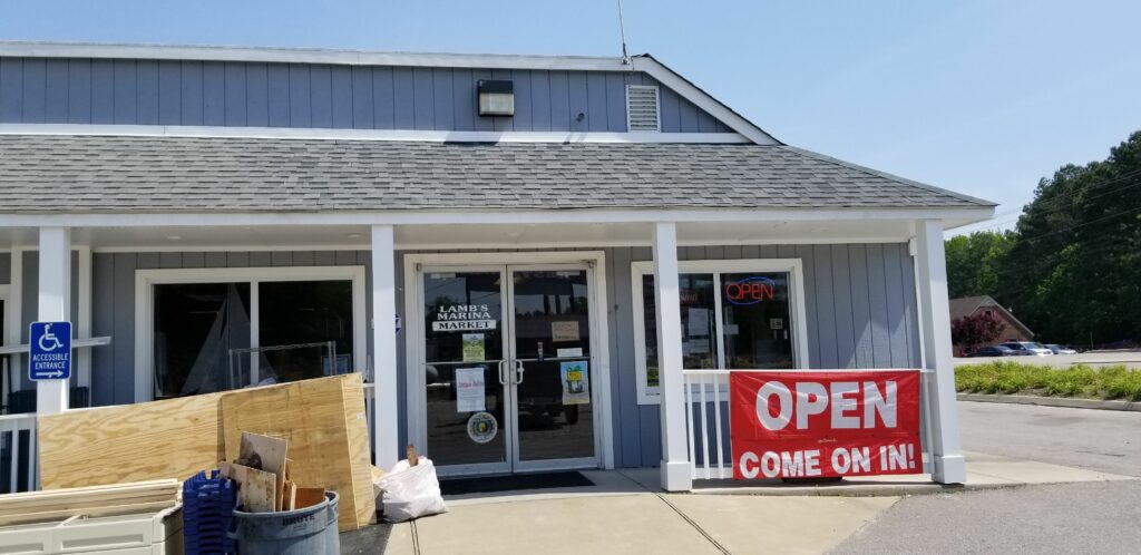
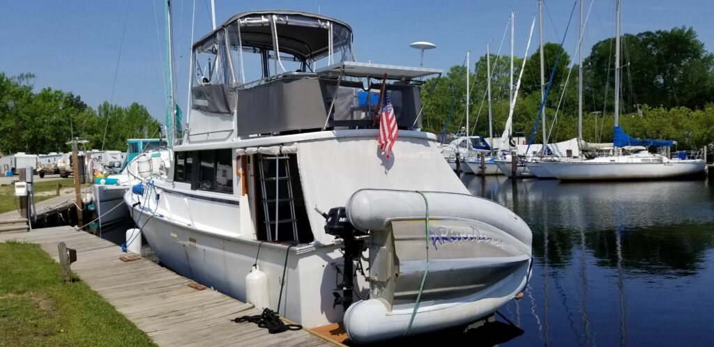
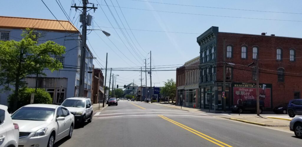
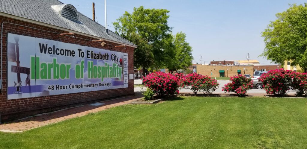
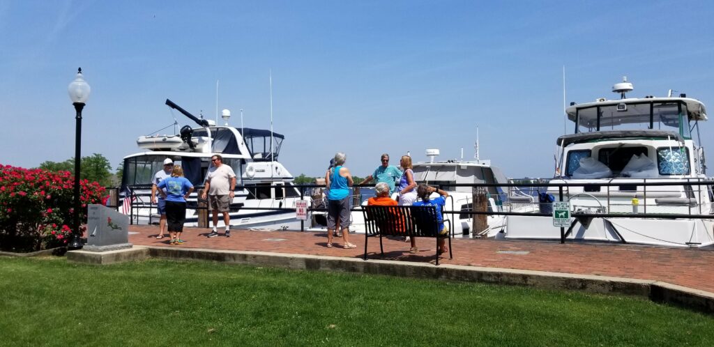
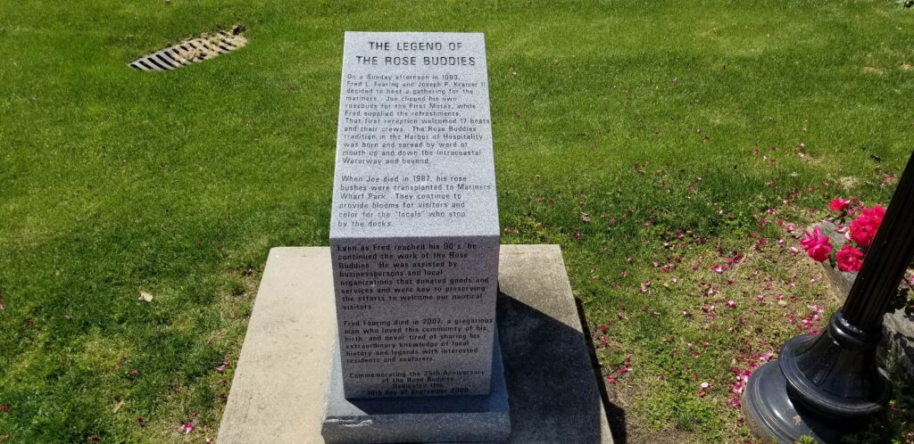
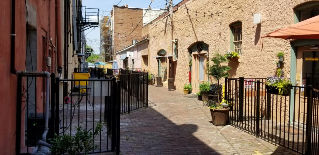
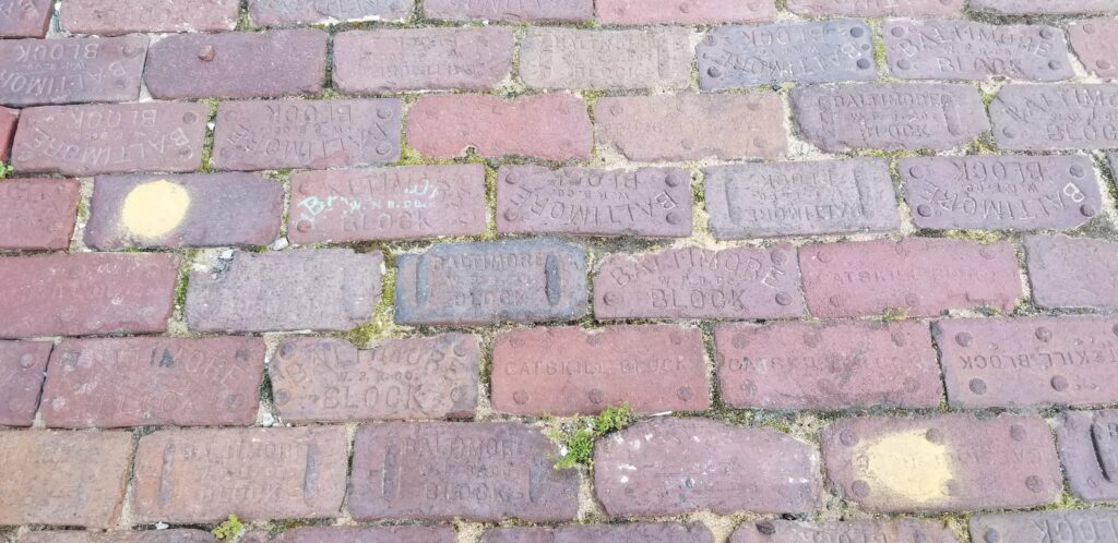
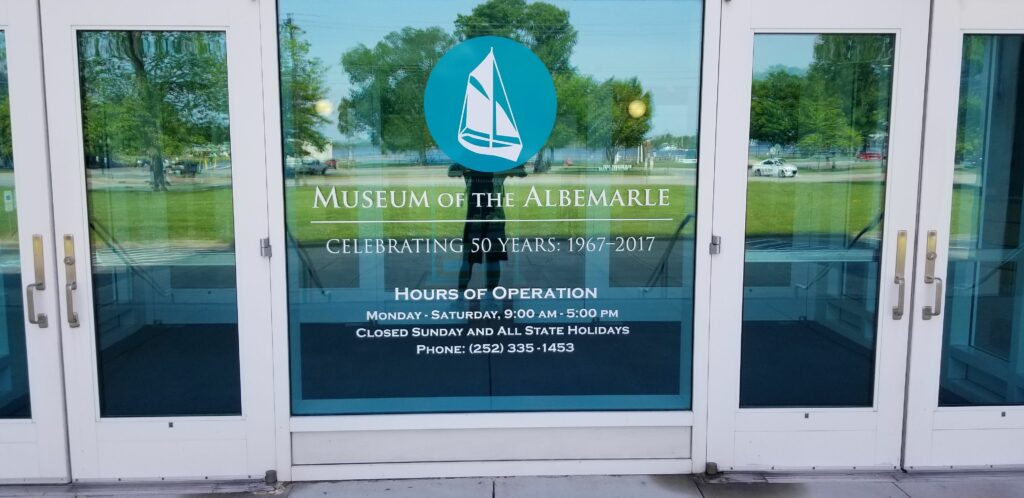
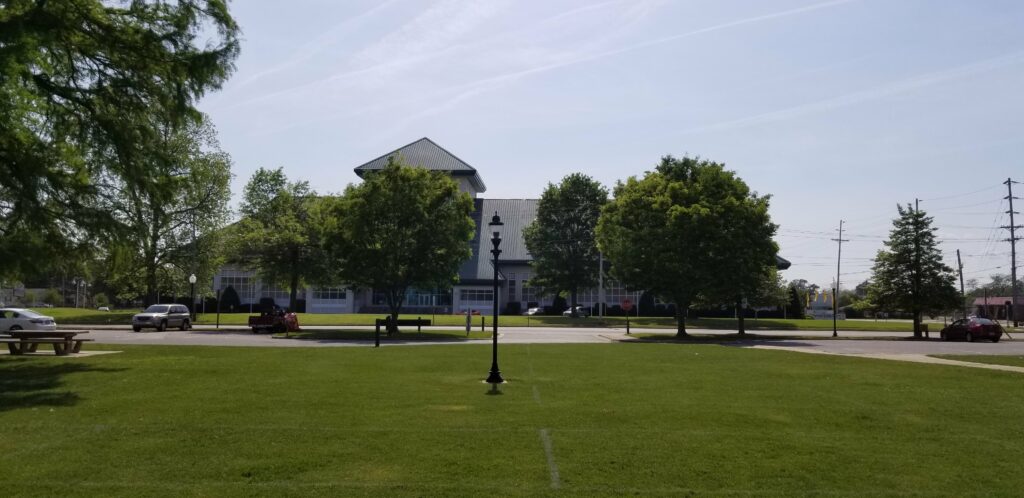
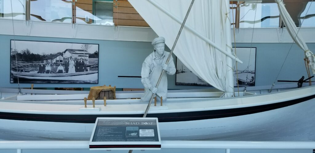
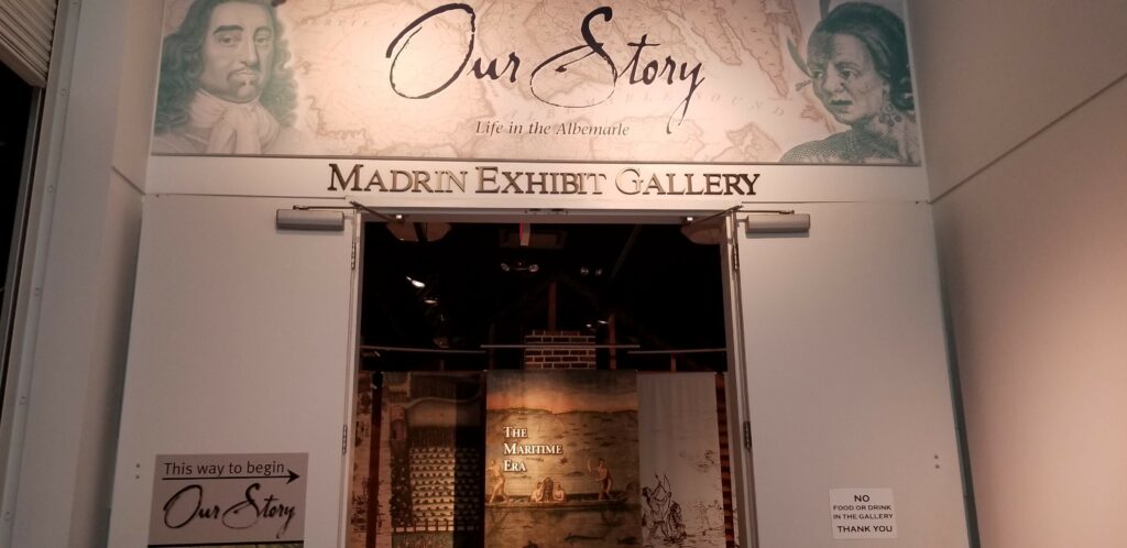
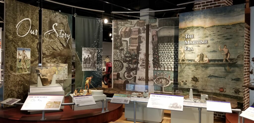
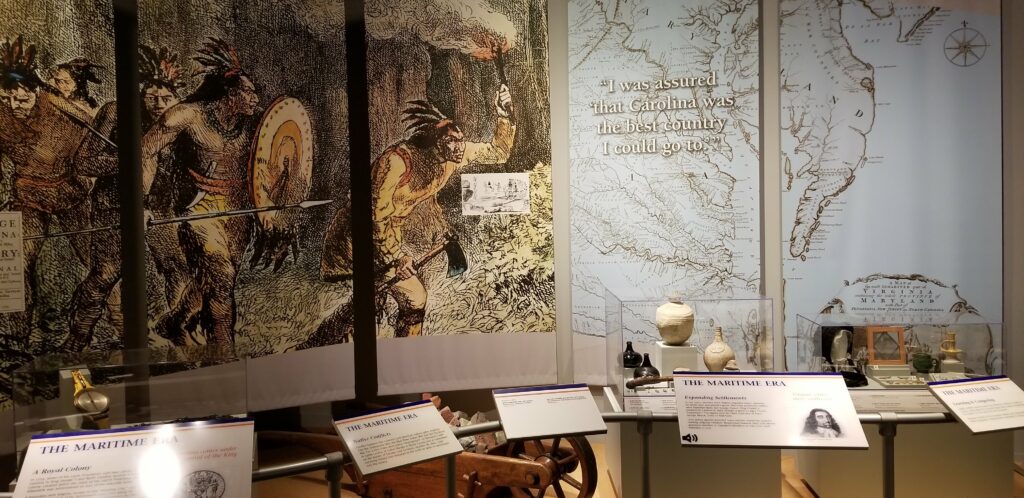
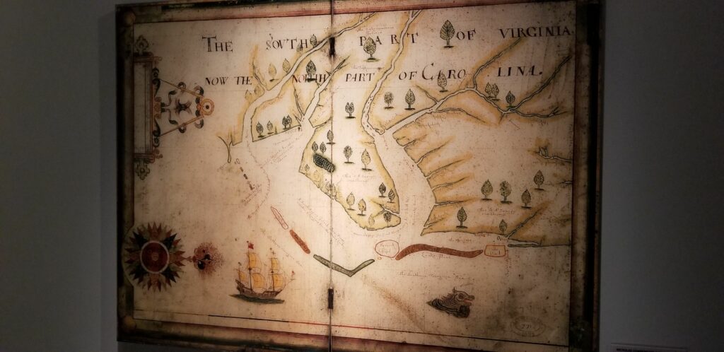
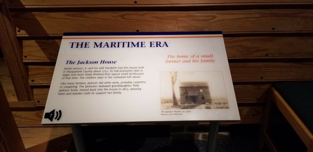
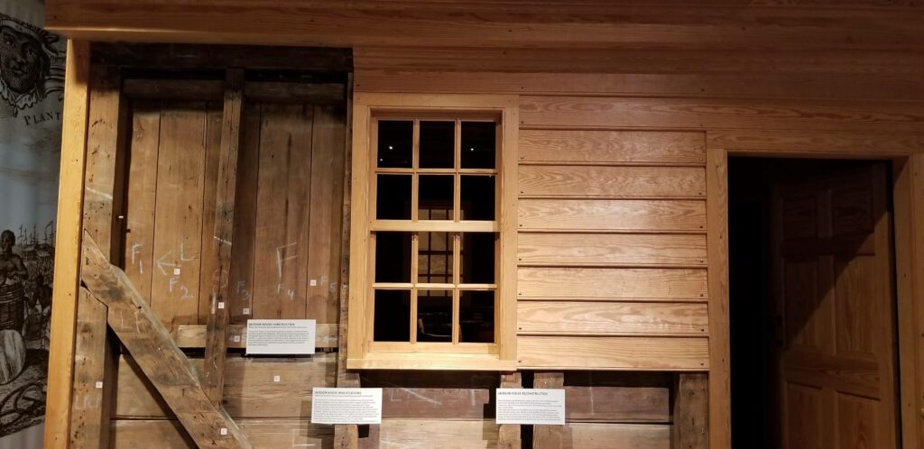
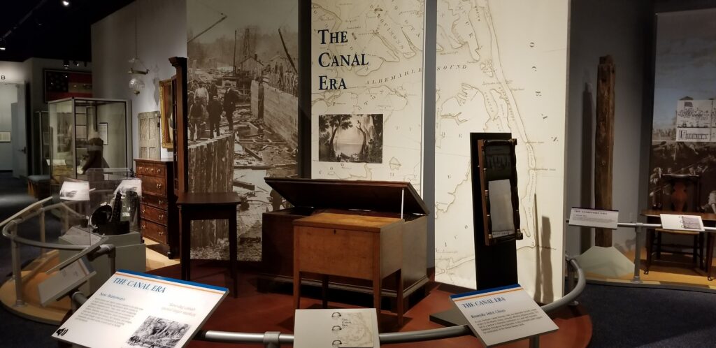
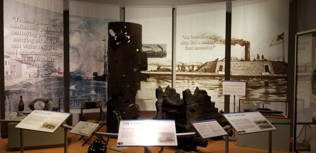
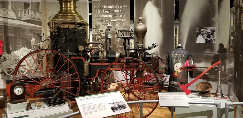
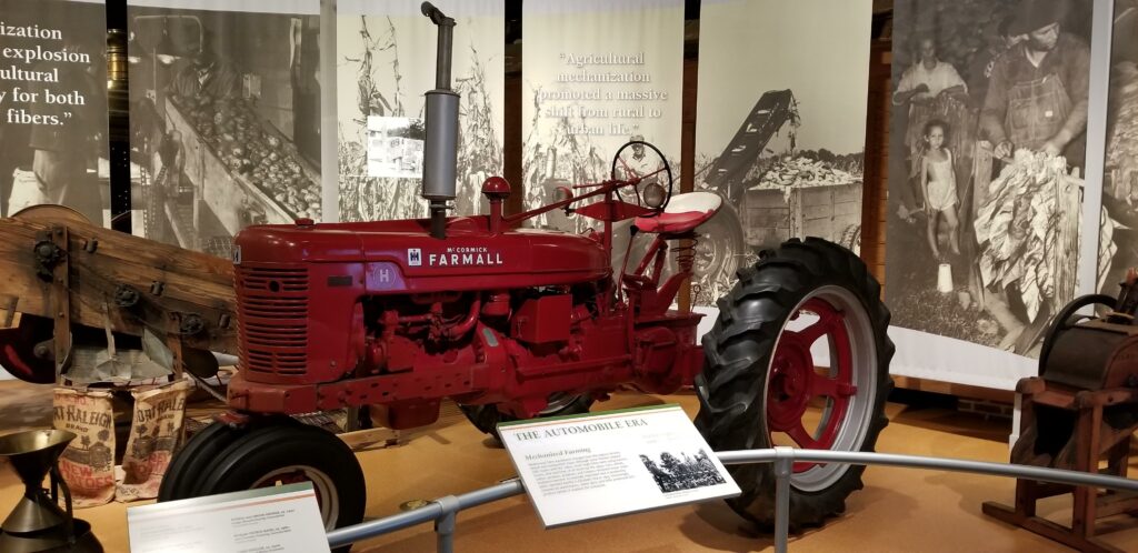
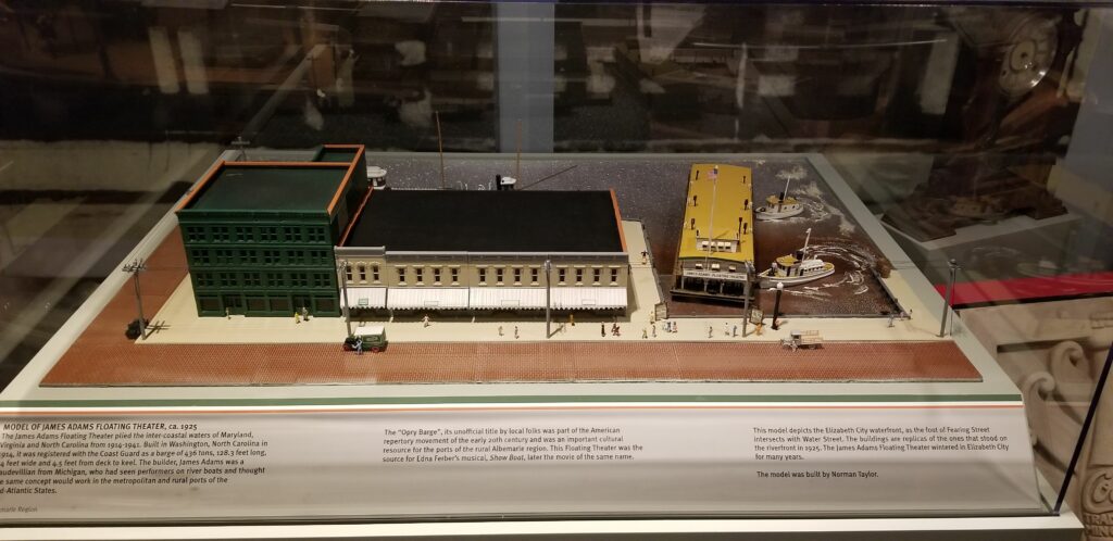
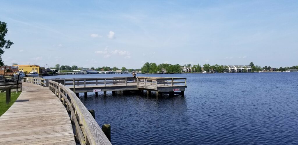
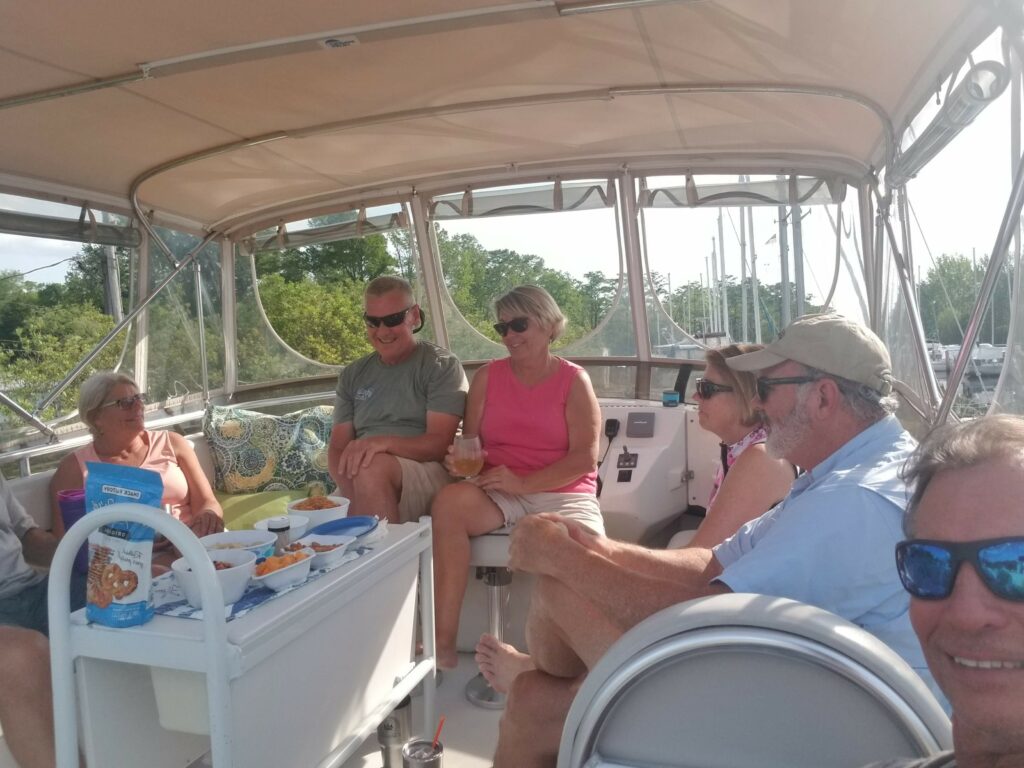
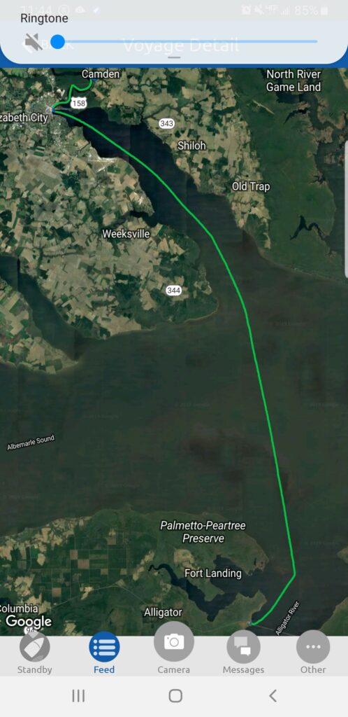
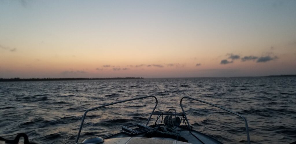
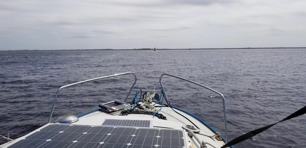
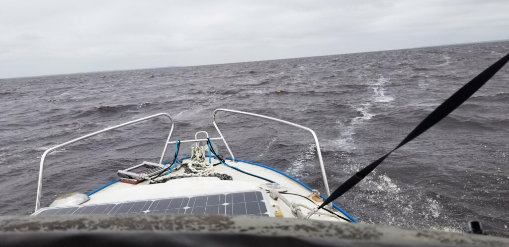
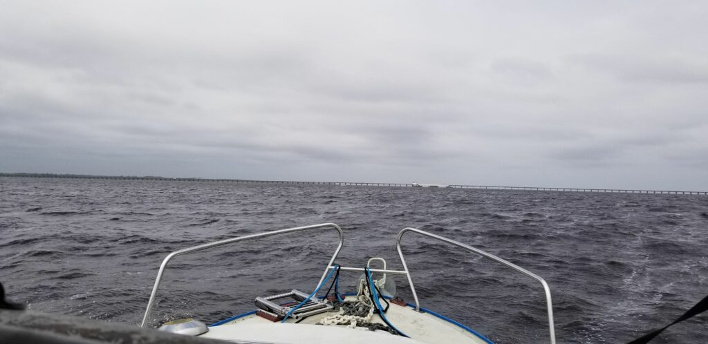
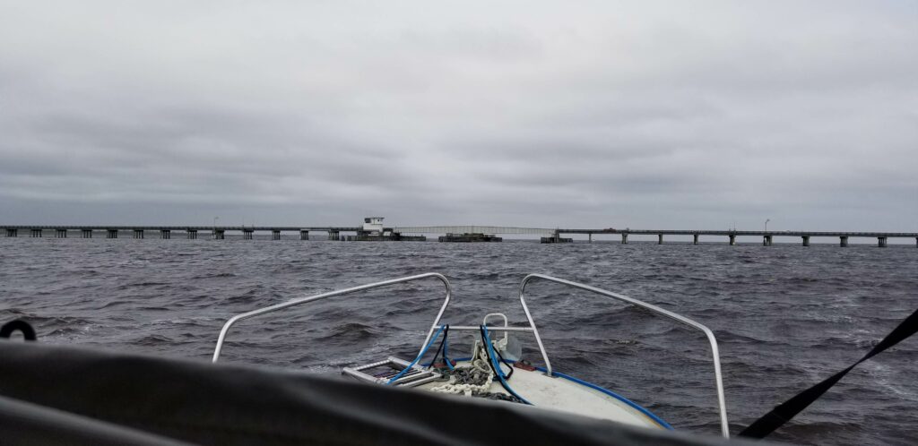
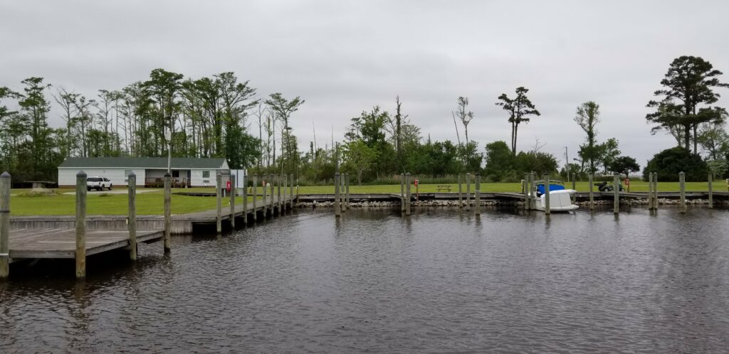
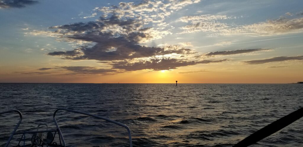
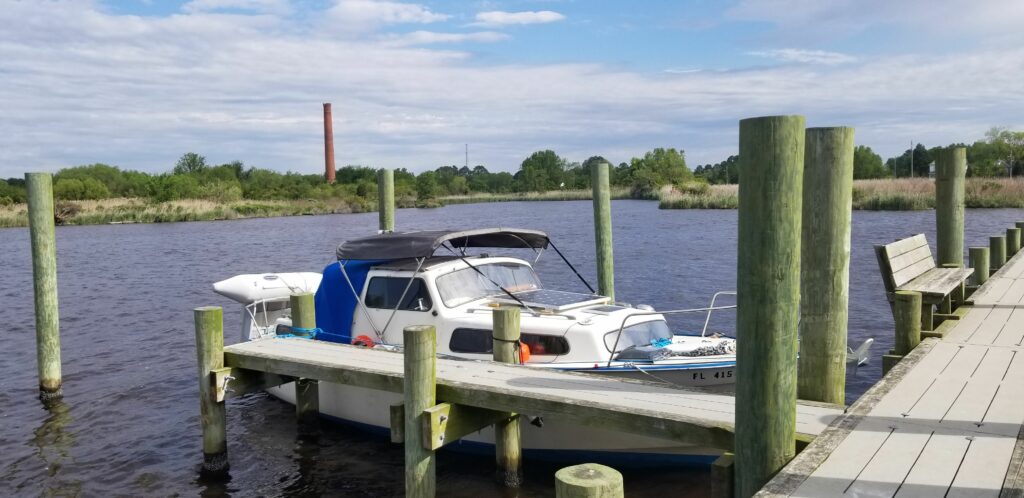
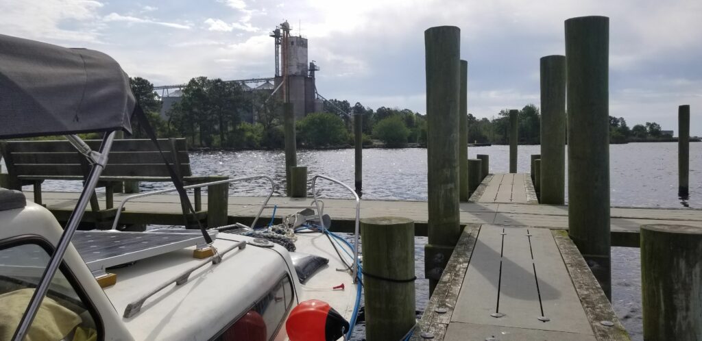
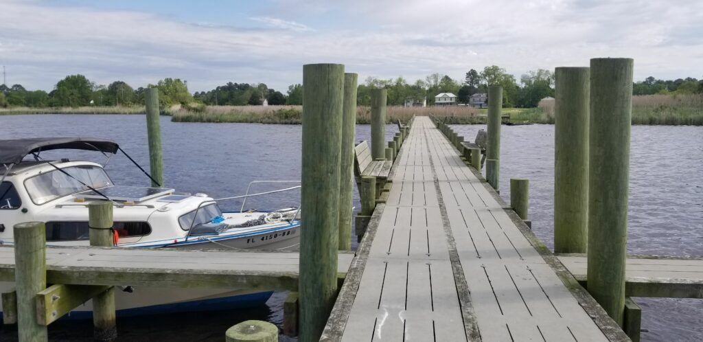
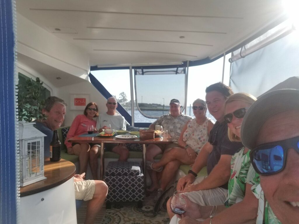
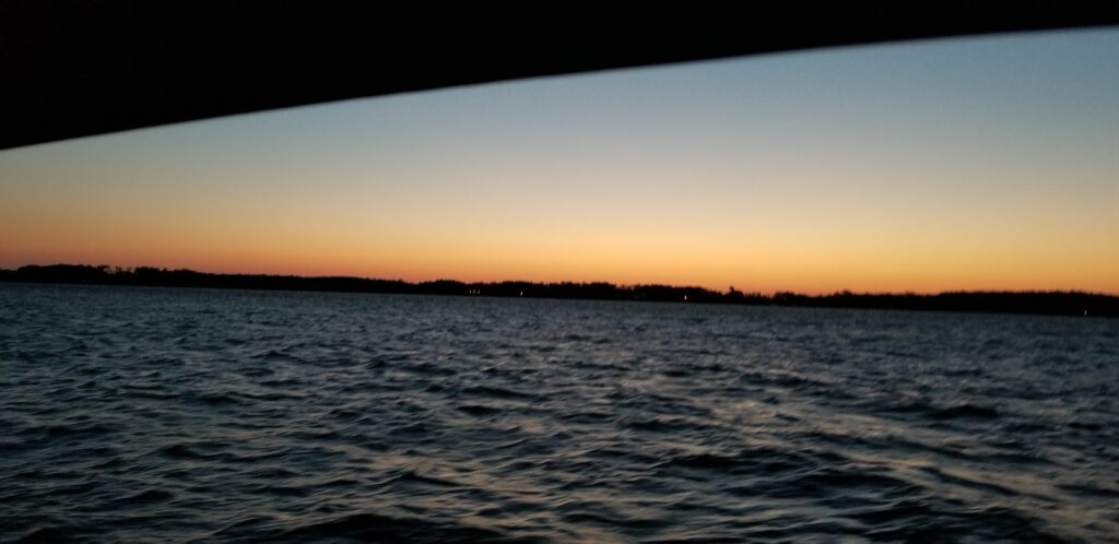
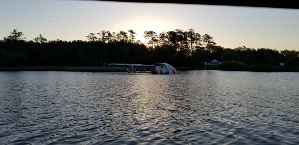
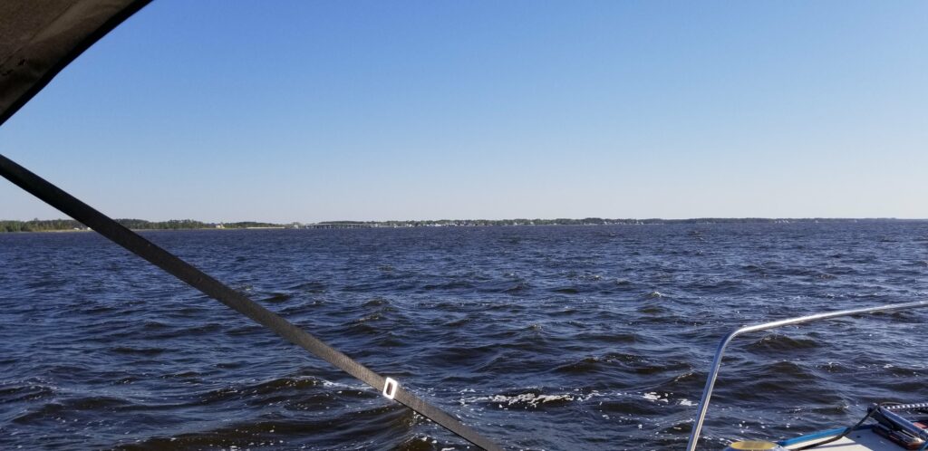
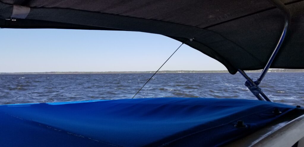
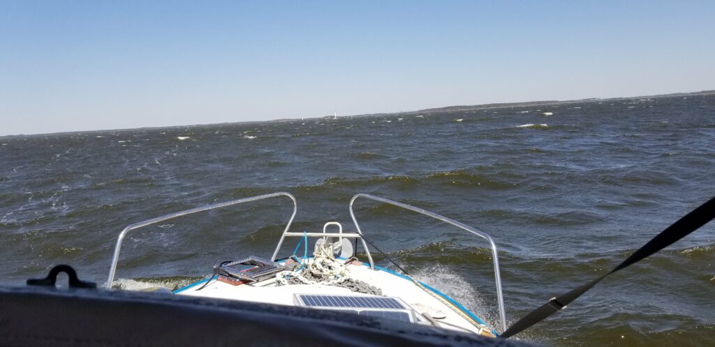
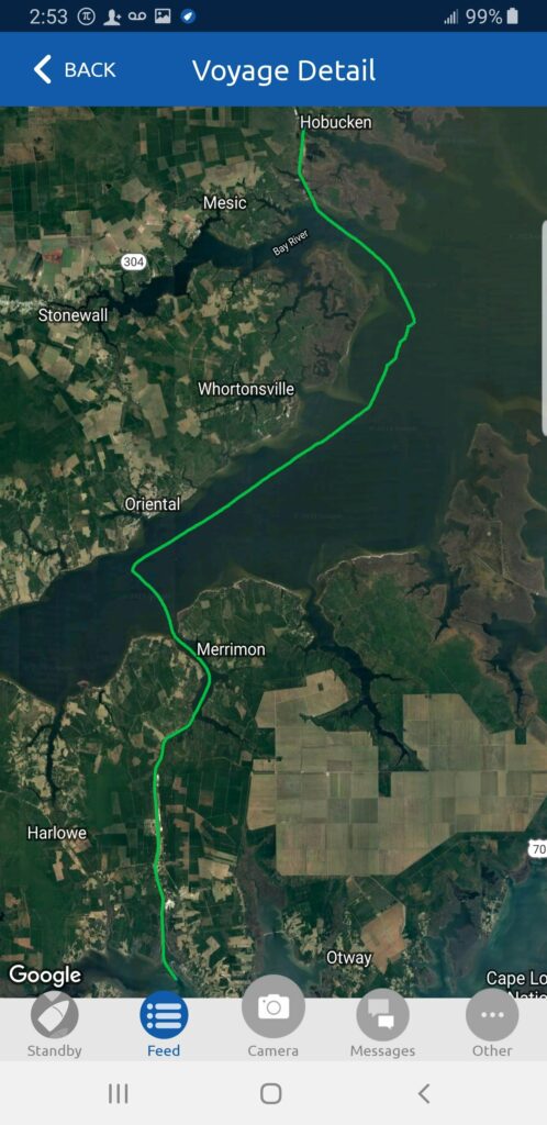
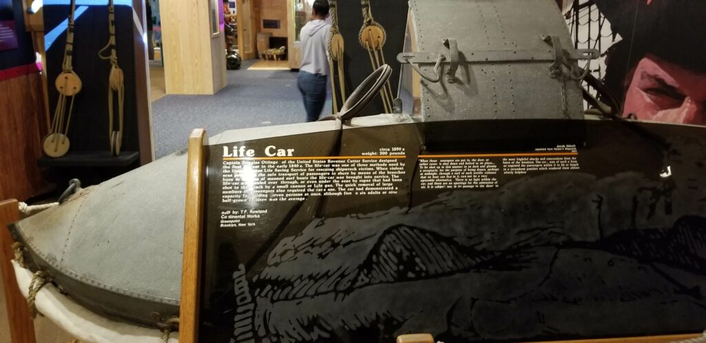
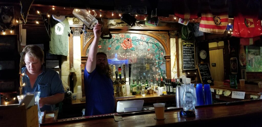
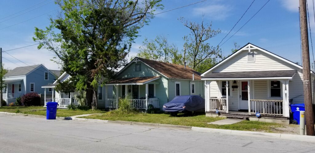
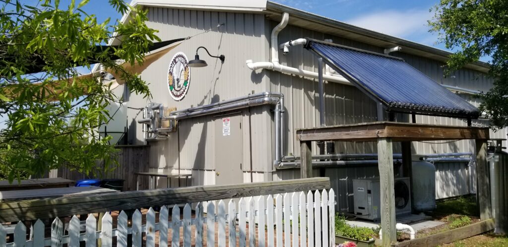
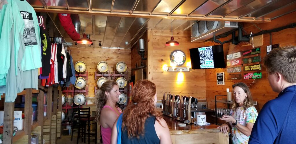
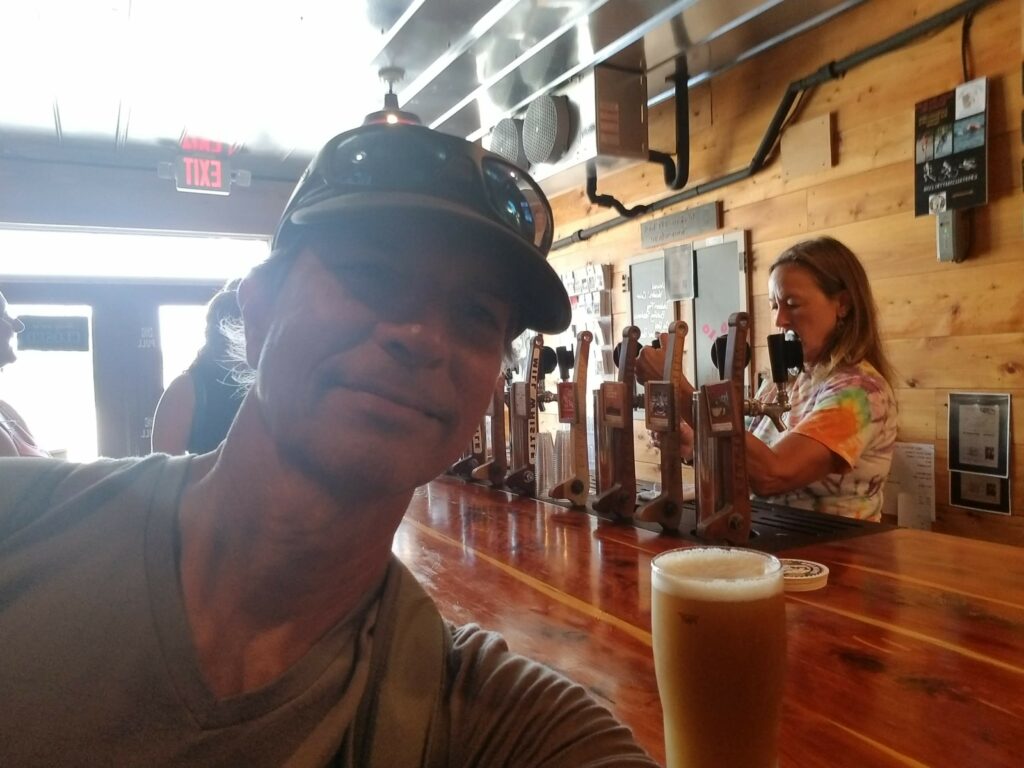
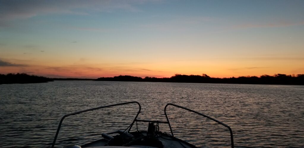
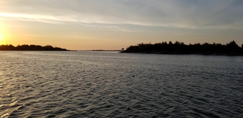
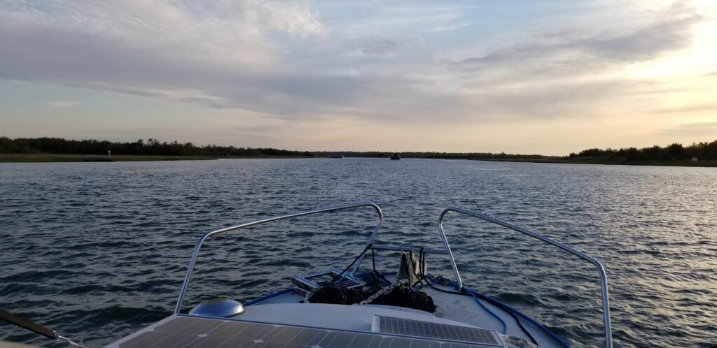
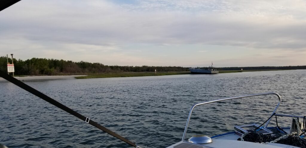
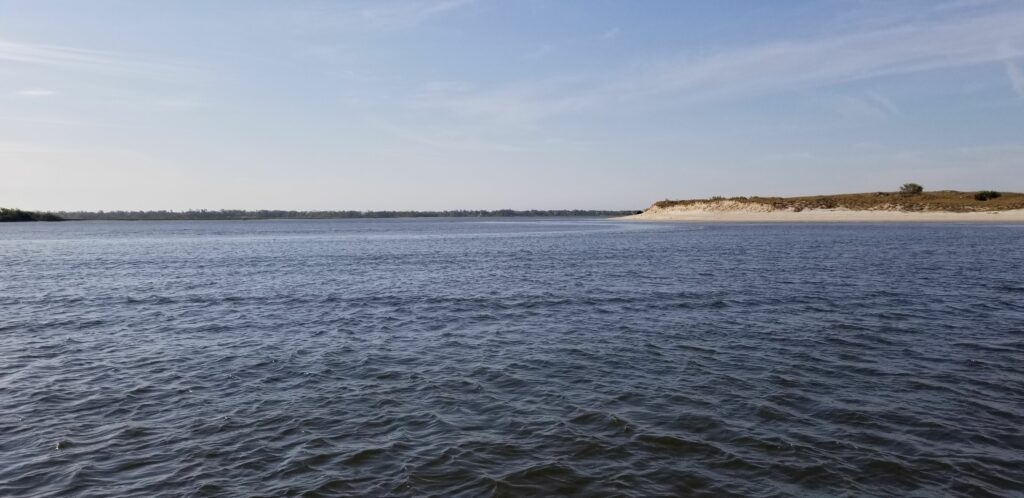
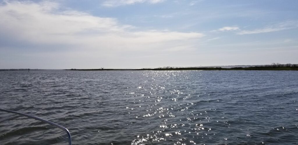
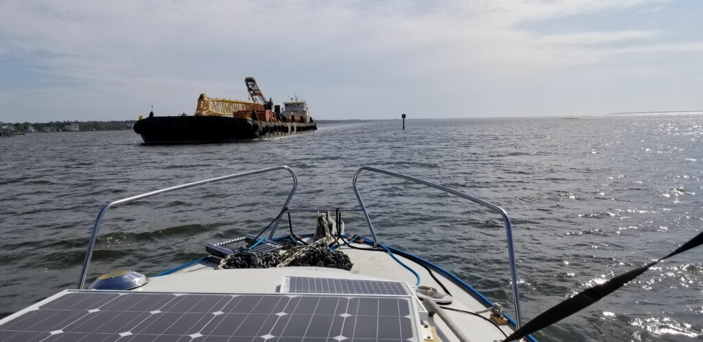
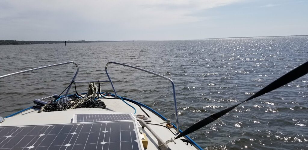
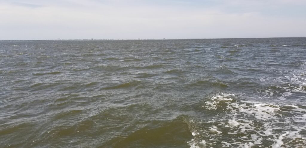
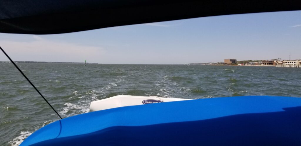
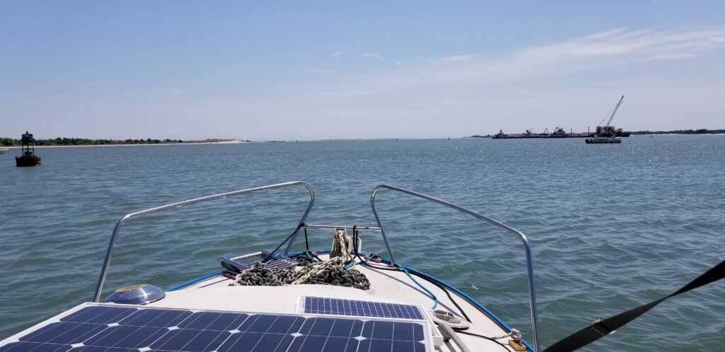
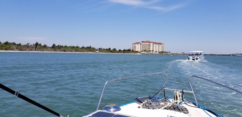
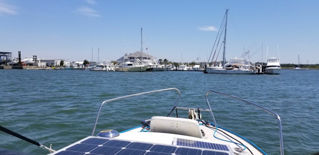
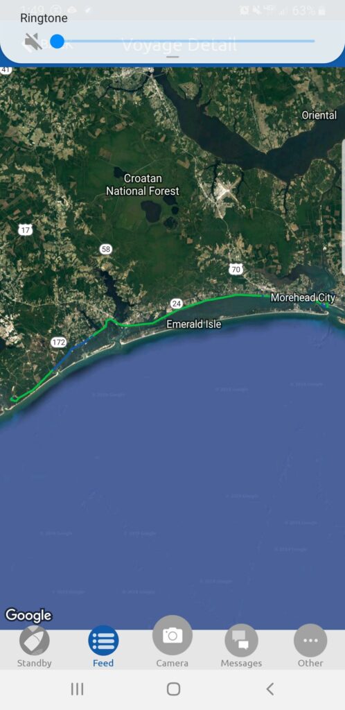
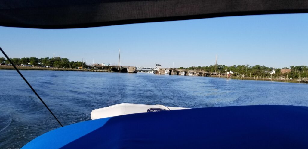
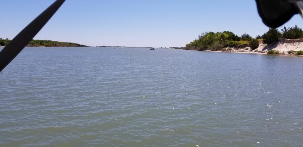
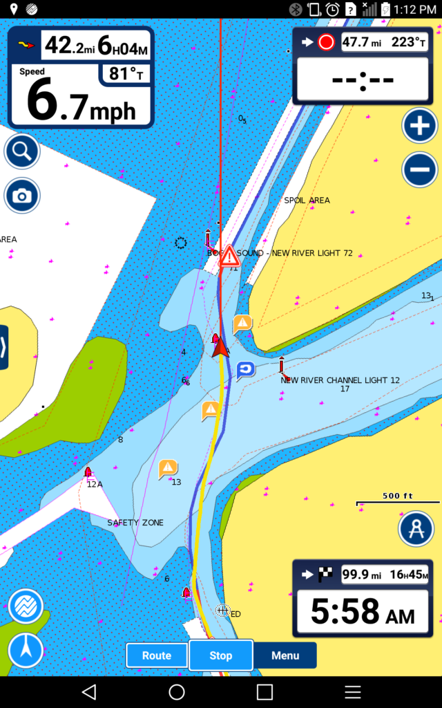
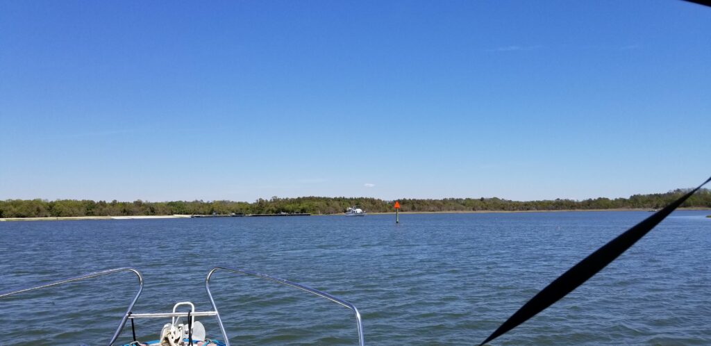
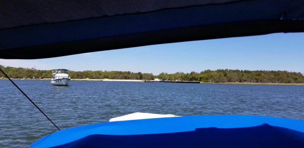
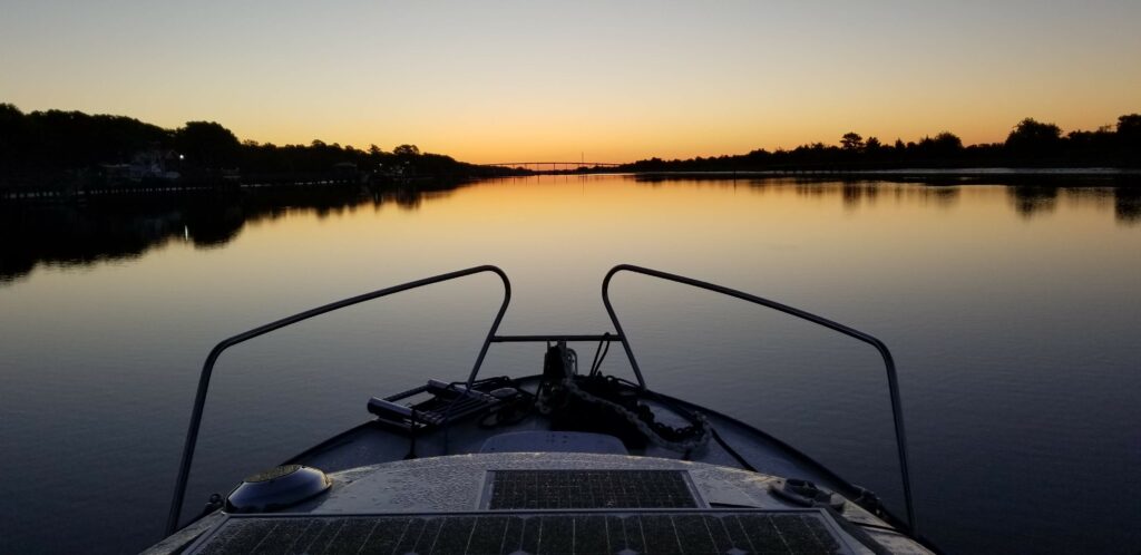
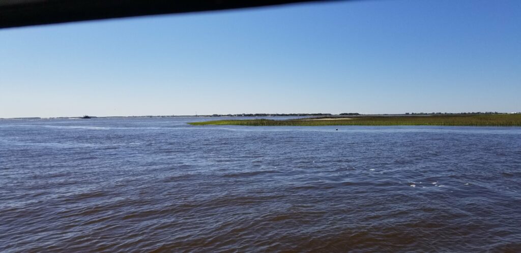
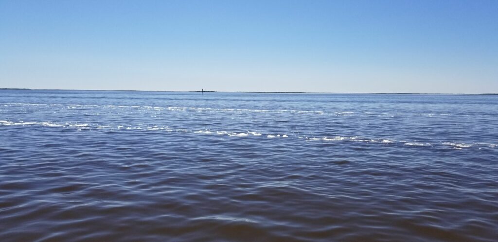
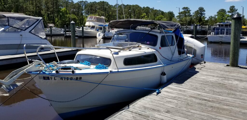
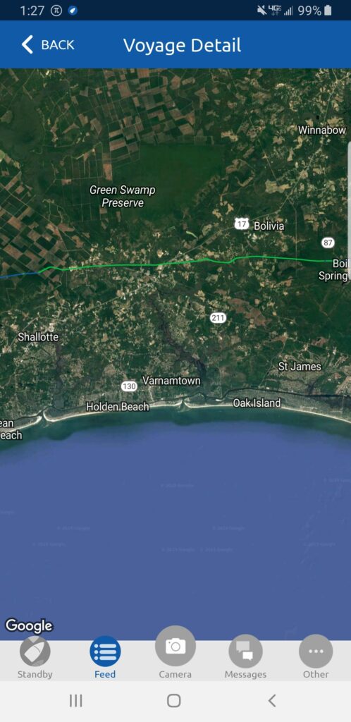
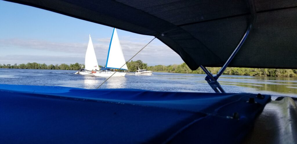
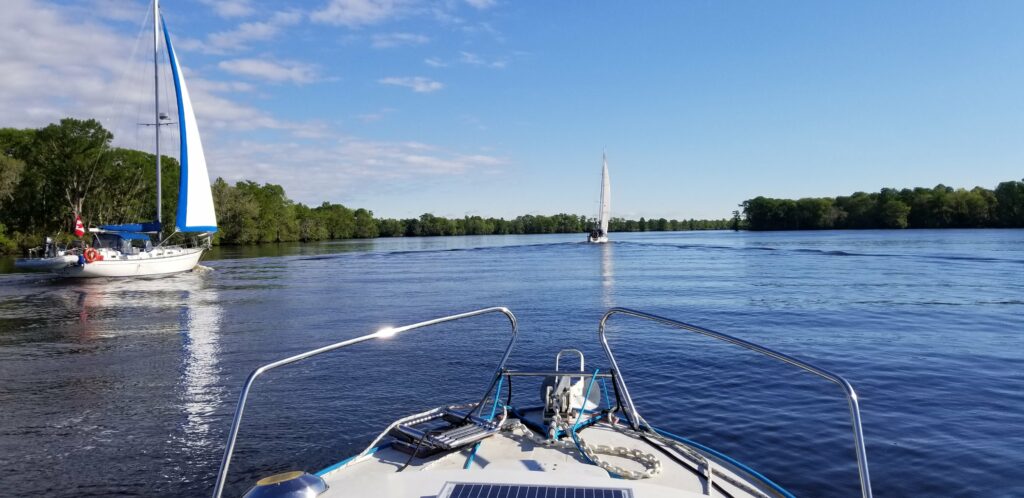
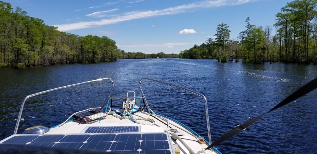
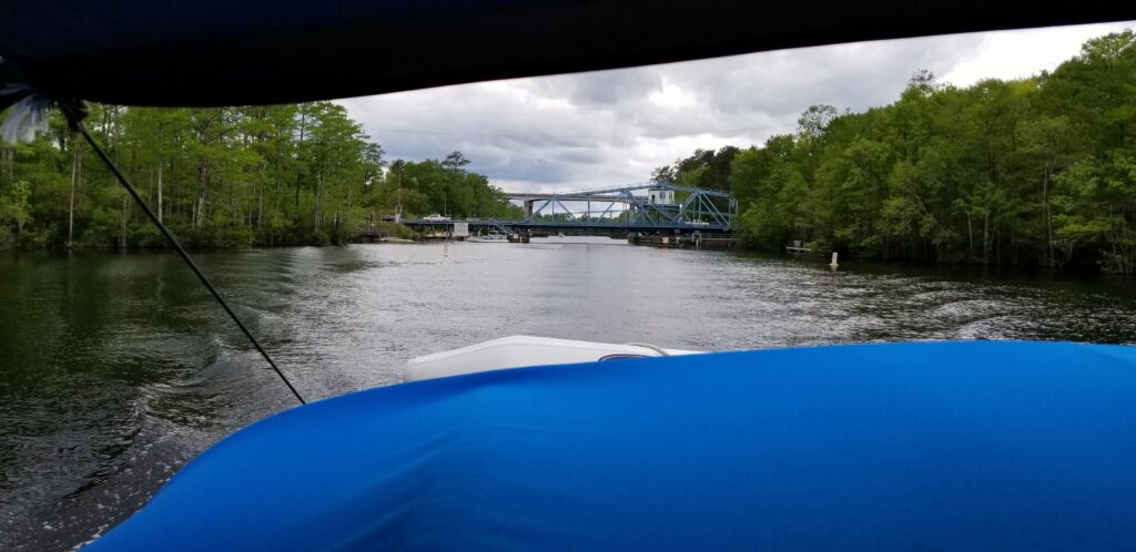
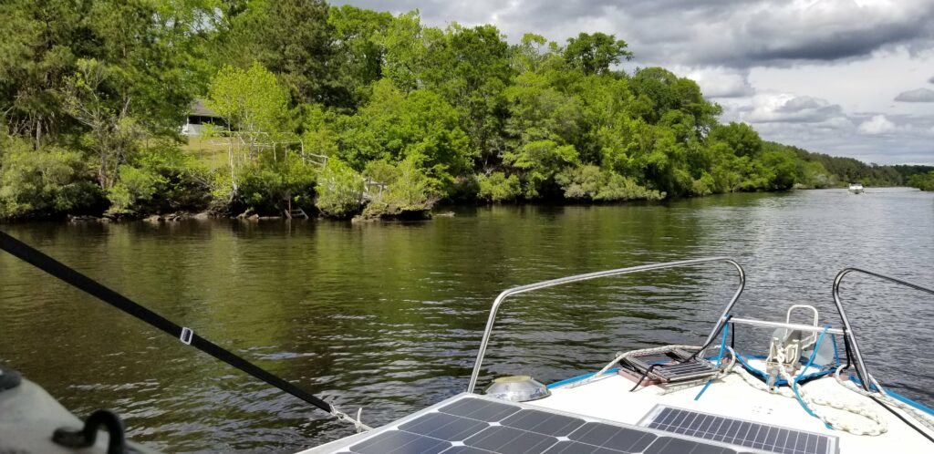
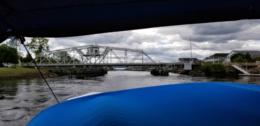
Left this morning at 5:30 to try to get across the Albemarle (20 miles across, which takes me over 3 hours) before the wind came up. This is my first view of the day – conditions are not bad – blowing about 10 mph, when the weather says zero (calm).I can see better now, to be able to see the markers and avoid the numerous crab traps…Sunrise is getting better, wind conditions a little worse.The sun is coming up over the horizon – I hope these conditions last my whole way across, about 18 miles to go at this point before I get to sheltered water.The wind is coming up and conditions are getting worse, the boat is rolling so much I have to stand and hold on – stuff is already on the floor. But, my destination, the sheltered point coming up is in view.Its blowing about 14 here, when it wasn’t supposed to be over 10 for the whole day – and it is only just after 7 in the morning at this point – good thing I left at 5:30!This is before the worst of it – still over an hour to go – during that hour I couldn’t even hold the camera, had to hold on with both hands to not get thrown off my feet.Across the Albmarle Sound and into more sheltered water now – whew! That large building was used in WW II to make and maintain military blimps. It is now a private military contractor make blimps for surveillance and communications purposes.Just passed Elizabeth City and went under their bridge – continuing on to a Marina further up the Intracoastal. Originally I had planned to stay at the Elizabeth City free docks, but when I saw that there was a bridge I had to go under, and the chart said the height was two feet, I felt I had to make the marina reservation and get through the bridge today. As I approached the bridge I was that it was not 2 feet – so I called the bridgetender and asked what the clearance was. He told me 12 feet, but as I got there to go under, I saw that the board said it was only seven feet! Luckily is was more like 10 feet, so I made it under.Coming into the channel to Lamb’s Marina. I decided to stay here because I need to get to the lock another 15 miles up the way by its first opening at 8:30 AM, and I was worried that the previous bridge would not open for me that early (of course I found out I could get under it anyway…).A nice marina – a lot of liveaboards and I’ve heard it is a great Hurricane hole. Adagio happily at the dock, with free power.The marina is also a gas station on the local highway – unfortunately, the restaurant was closed. A lot of us here were looking forward to going there. Later I rode my folding bike back into Elizabeth City to see my friends who were staying at the free docks and tour the town – the road is definitely not bike friendly!The were remodeling the office and store, which is why the restaurant was closed.These are my friends on A River Derci (you can see the name on the dinghy). Been travelling off and on with them since Beaufort NC.The front street of Elizabeth City – the free docks are a little was down the road.Elizabeth City has been welcoming Great Loopers for a long time – the roses come into play in a moment, everyone who landed at the free docks today was handed a rose as they got off their boats.These are my Great Loop friends at the free docks – Bella Gatto in the middle.The stone monument that explains the roses – the Rose Buddies.The local brewery – in an alley paved with bricks. Unfortunately, it was close – but, at the next bar I went to with the guys from Bella Gatto, they had some of the brewery beer on tap. I mixed the two they had and really enjoyed it – then got to meet the brewery owner and he though it was pretty cool that I had done that.The brick pavers in the brewery alley.Went to this amazing free museum in the town.The museum takes up most of that huge two story building – very friendly people, and as the next photos show, great presentation of the local phases of history in the area.Full size shad boat hanging over the lobby.“The South part of Virginia now the North part of Carolina”.An original 1700s home moved and put up in this museum…The origins of the Dismal Swamp Canal, which I will traverse tomorrow.An original fire engine.And an old farm tractor – I figured my friend Grant would like this…A roving playhouse, moving up and down the rivers town to town.Elizabeth City waterfront – I really like this town.Happy Hour with the Loopers here at Lamb’s Marina.My route today – tomorrow the Dismal Swamp and Norfolk.
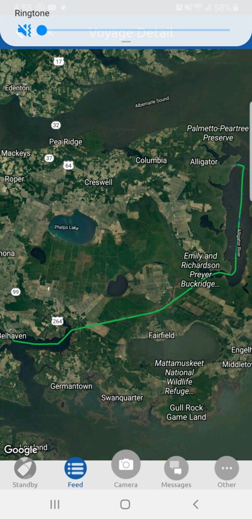
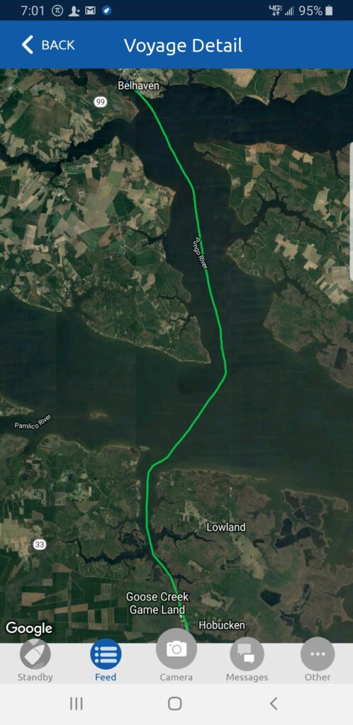
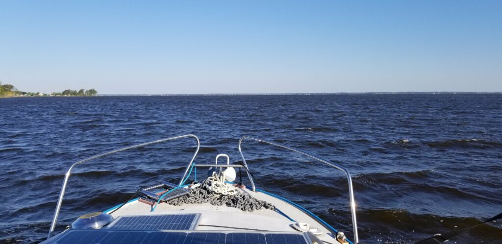
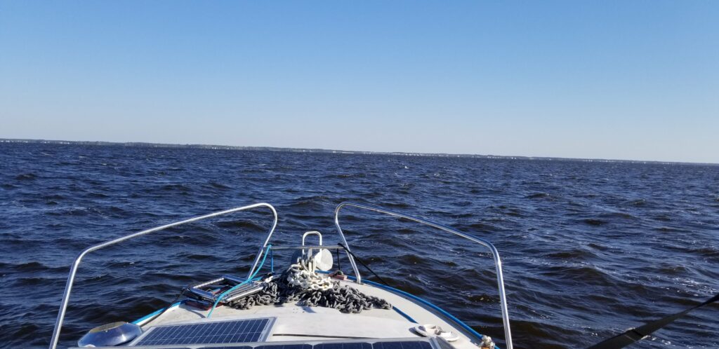
First view of the morning – left Belhaven at 5:30AM hoping to beat the weather – weather guys got it wrong again today, it was already rough, supposed to be 6mph.Got to the protected part of today’s journey – just got passed by Done Diggin, the large Lagoon power cat. Started off at 55 degrees this morning, and stayed that way until 10AM – the high for the day was 61.I thought the Neuse was bad – this was worse. Almost turned back about a third of the way up the Alligator River. Some of the waves were so big that the boat launched off them and about half of the boat was out of the water before it came back down – I actually had to slow down. The only reason I kept going was that it was supposed to get better, and I was heading almost directly into the waves – the boat’s best direction. Turned out the wind did not get better…After 3 hours of getting beat up, the Alligator River bridge came in site – near the end of today’s journey.The Alligator River bridge – just 11 feet clearance but I only need 8, so I got under it no problem.The Alligator River Marina is basically a gas station on a highway with a marina – really laid back and inexpensive. So glad to be here!The marina. Bella Gatto is here now as well.Adagio’s spot – the building to the left is the laundry, restroom, showers and lounge.This was my route today. All the pain of the last three days is to get across the Albemarle Sound (over 20 miles across, and a body of water I couldn’t get across in Catitude for three days last year). The weather tomorrow is supposed to be ideal – really hoping so…
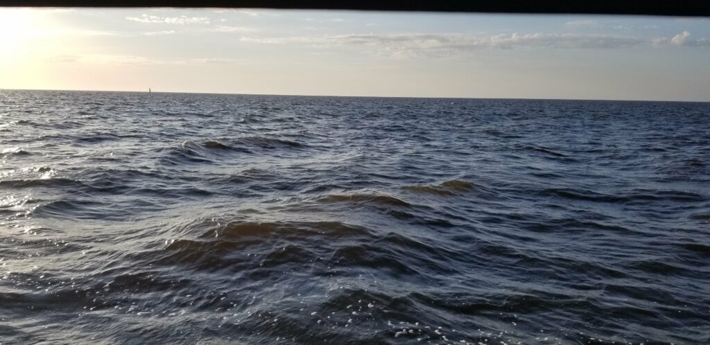
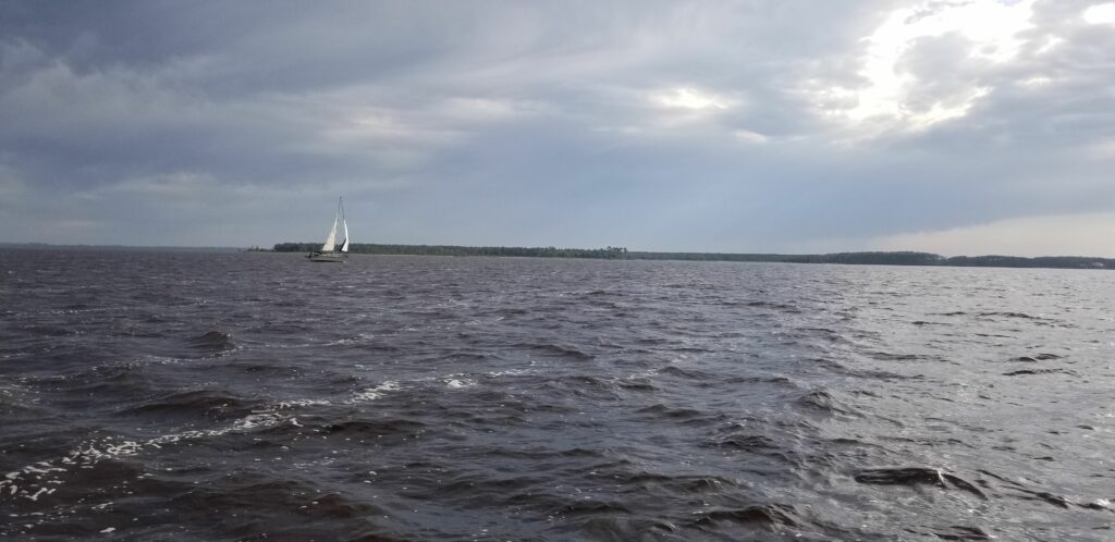
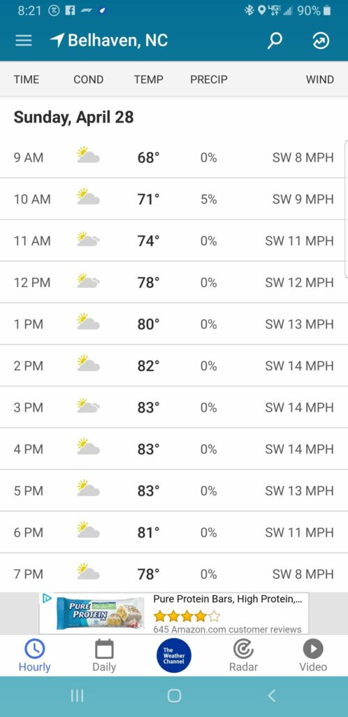
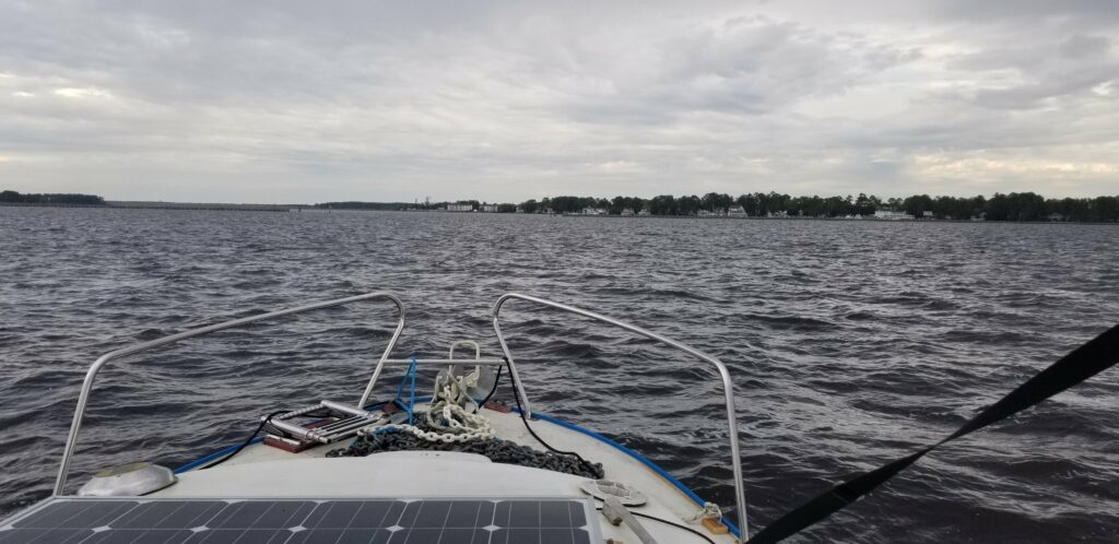
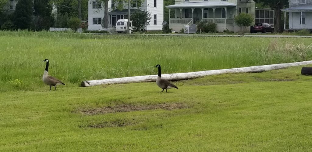
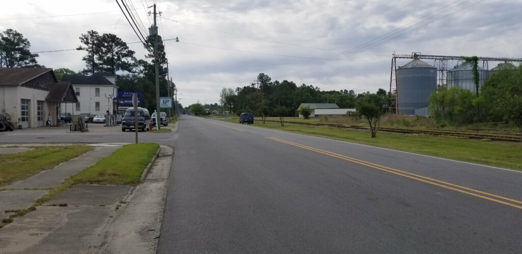
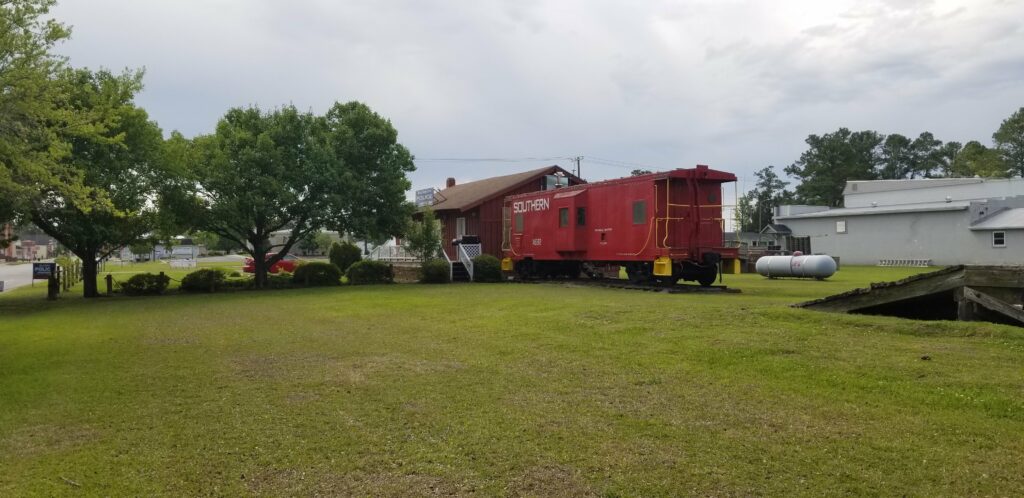
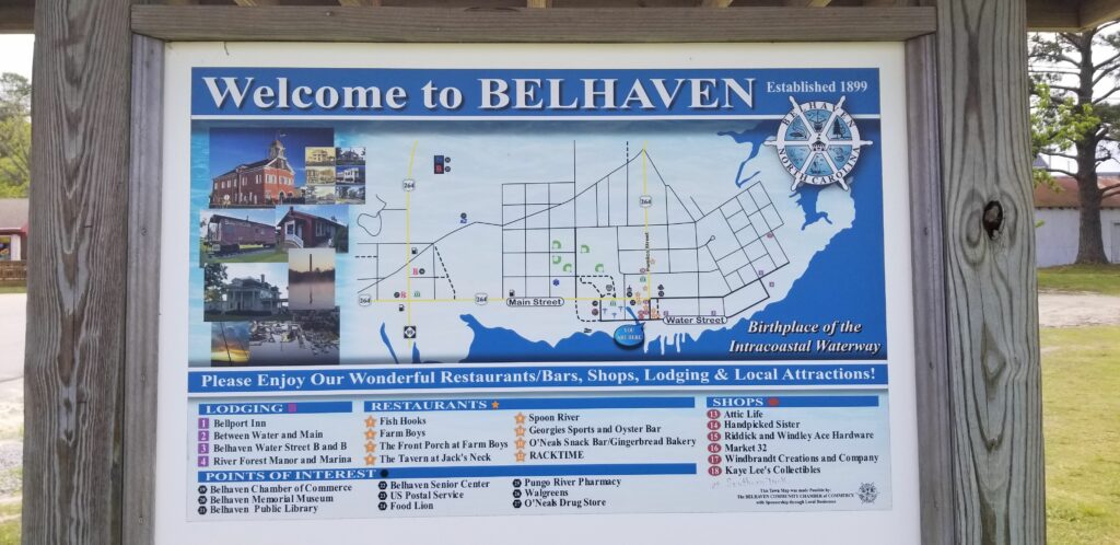
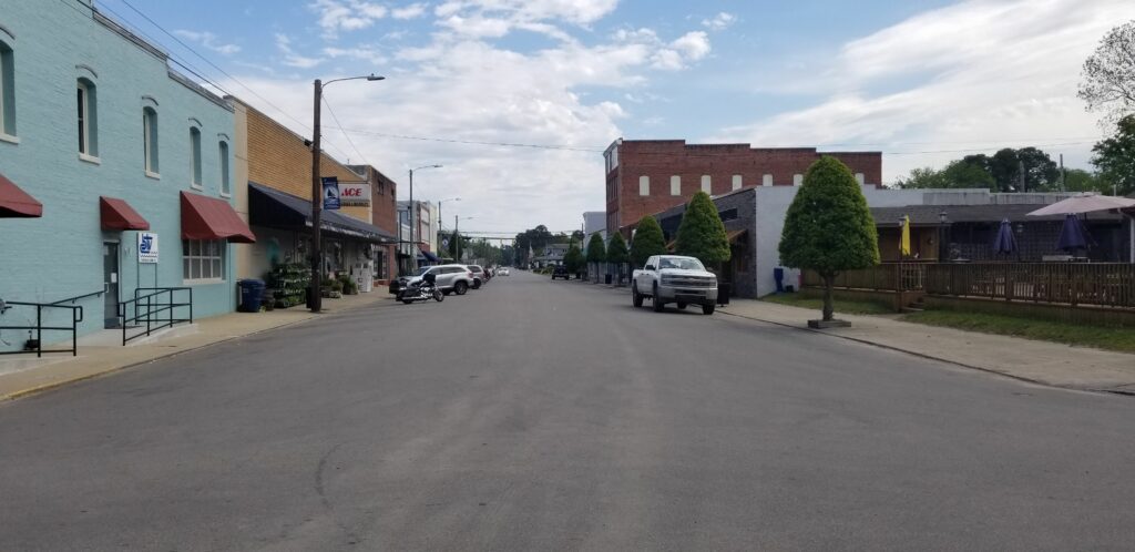
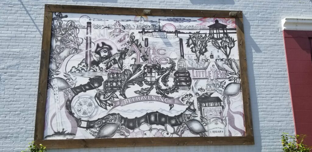
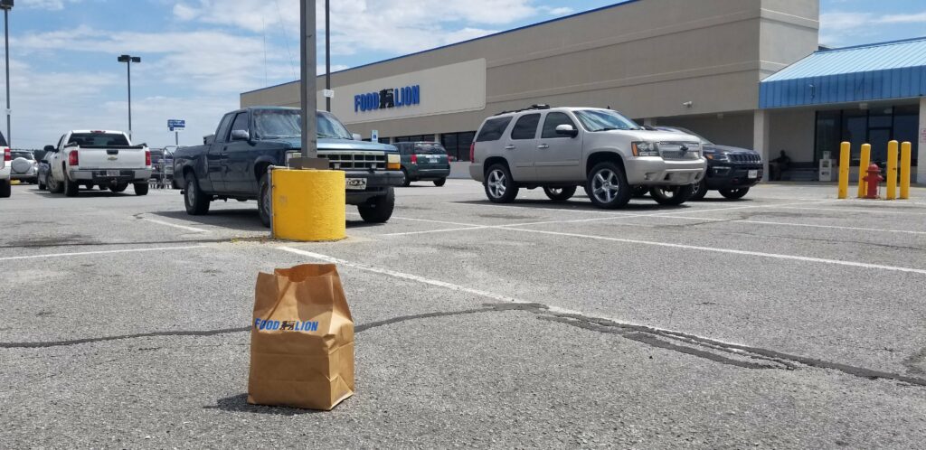
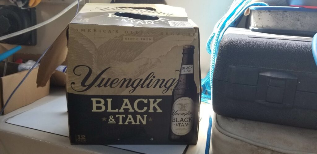
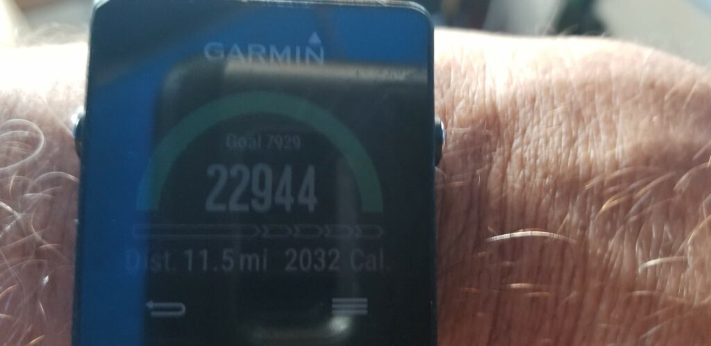
First view of sunrise – I can barely see the markers at this time, left at 5:40 AM. I needed to get to Belhaven before the weather (wind and waves) moved in.Sunrise greeting me as I enter the Pamlico River – even wide than the Neuse River from the day before. Once again, it appears the weathermen were not exactly correct in their forecast.Here, the waves are almost sideways to me before I round the point to the Pungo River – the boat is rolling pretty badly at this point, although not as badly as yesterday.The wind was supposed to be 8 to 8 mph at this point, but here is sailboat heeled over with so much wind that they had to reef their sails.This is the weather from weather.com – obviously wrong, and the conditions are getting worse…Luckily I only had 4 hours to go today, so I was able to get to the sheltered harbor in Belhaven before it got really bad.My spot at the Belhaven Free Docks at the end of town – nice new docks, except they didn’t make the finger piers long enough, my boat is sticking out and it was hard to figure out how to tie it to the dock with the wind and tides that would occur during the day.My view of Belhaven industry.I did manage to tie the boat well, and the tide and wind did not cause me any issues.These Canadian Geese greeted my as I came off the dock.My view down the road towards town from the lot the dock is on. I decided not to get the bike out today, because everything was not too far away, and I had gotten here early and had all day.The Police Station – a caboose from the now-defunct railroad is used by the town from time to time for festivals.And the town of Belhaven welcomes me – pretty small place, and most of it was closed because it was Sunday.The view of downtown – very close to the marinas all the rest of my Great Loop friends who were here today stayed at.A collage of Belhaven highlights on the side of a business.The Food Lion was 1 miles away – so I walked there, and then found out that no beer could be bought there until noon (I was lucky it could be bought at all today – North Carolina has very strict alcohol laws). So, I went back past the boat and to the marinas half a mile past that, then toured the town. By then, it was a good time to head back to Food Lion and buy the beer, so I walked the mile and a half back there and bought a 12-pack of Yeungling Black and Tan. I had them put it in this paper bag so I could carry it back to the boat…As I was walking through the Hardees parking lot next to Food Lion on my way back to the boat, this guy asked me if I could use a lift. I said sure, that would be great, and he drove me back to the lot where the docks are. Very nice guy. Actually ran into him later in the day at the Ace Hardware – the largest one I have ever been in. Also in there was the guy on the sailboat sharing the free docks with me.This is the empty 12-pack case on the boat – loaded all of the beers into the refrig, it was getting empty.The crew from four Great Loop boats having happy hour on the biggest one in the marina – a very large Lagoon power cat. Turns out we are all leaving in the morning and going to the same marina – so we will see each other again tomorrow.The end result of all of the walking today – almost 23000 steps, about 11.5 miles…My route today – a relatively short one. Tomorrow will be 55 miles to the marina on the Alligator River, staging for the Albemarle Sound crossing the next day.
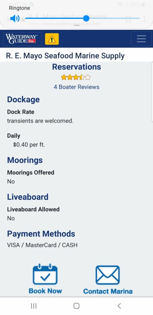
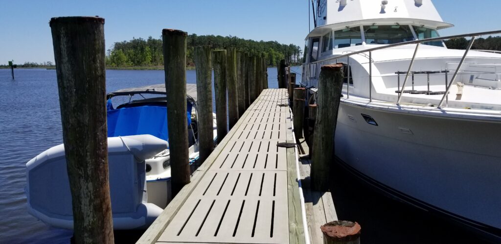
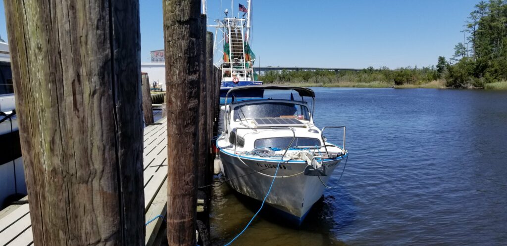
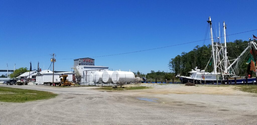
Sunrise – I wasn’t even sure I was going to head out today. I was concerned about my repair yesterday and not sure it was the only issue I had – also, the weather forecasters were way off about today’s weather. It was supposed to be blowing 13 mph, but instead it was 18 mph. I left anyway, believing (per the weather men) that conditions were only going to get better…I got through the relatively protected waters near Beaufort without any issues – engine ran fine and no white water over the boat. This guy was not so lucky…Heading out into the open water of the Neuse River – over 3 miles wide. My goal yesterday had been to go to Oriental – almost directly across the river from here, but with the day’s delay, I decided to head for my next destination (where I should have gone today), Belhaven NC. To minimize my time on the open water, I headed straight across as if I were going to Oriental, even though my destination was North – up the river.The bridge across from me is Oriental – I visited there last year when I brought Catitude home, so skipping it was no problem. I knew the wind was going to increase slightly before it decreased later in the day (per the weather men), so getting close the other shore quickly was a priority to lessen the impact of the wind on the waves in the river.Here I am passing Oriental. I couldn’t go straight across to there because the size and direction of the waves coming across – I had to head more South and get as close to the shored as I could, then head North. The shoals go far out into the river, so I could not get as close to shore as I had hoped.Instead of decreasing as predicted, the wind was actually picking up. It was also changing directions more to the West as I went.This wasn’t actually the worst I encountered today – when that was happening, I couldn’t even hold the camera and spray from the boat hitting the waves was going all over the boat.When I left the Nuese River (I basically got SLAMMED there) and got into more protected water, I looked for a marina to stop at and found this one – just up the waterway. I was so tired, I just couldn’t handle the next large body of water which was coming up before Belhaven with the wind ever increasing. Whats great about this place is that it is very well protected, and is only 40 cents a foot ($10 for me) which INCLUDES electricity. Also they have relatively inexpensive diesel.So, I pulled in here and filled up with diesel (a little over 24 gallons, which means since the last fill up, I have gotten 16.3 MPG!).My dock spot behind the shrimp boats, with free electricity – which I don’t really need, but is nice to have to fully charge everything.This place is in the middle of nowhere, on its own street by the bridge. To do this post, I had to sit at the extreme end of the dock and point my phone a particular direction to get one bar, and use it as a hotspot for my computer. The connection was so slow, it took me over an hour to complete this.This is my route today – about 45 miles in 6.5 hours. Tomorrow, I’ll leave early and make Belhaven.
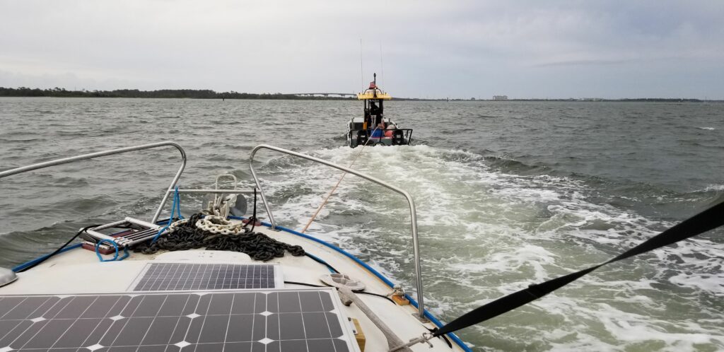
This is how my day started – being towed back to the Town Creek Marine by Sea Tow. Left the dock this morning at 4:45 to try to get to Oriental before the big storm front came through. I made it about 2.5 miles and the engine slowed down and then died. I immediately anchored, and tried to get the engine re-started. After a while, I was successful, so I pulled up the anchor (a big job because I have an over-sized anchor and chain) and started off again – but it only ran for about two minutes. So, I re-anchored and tried again to get the engine going. I figured I would now head back to the marina. Got it going again, pulled up the anchor once more and started back, but this time the engine only ran for about 30 seconds. I re-anchored again and then called Sea Tow. About an hour and a half later, I was being towed back to the marina.The Sea Tow guy was great and very professional – here you can see that he is towing faster than my boat can go under its own power! I wish I had taken pictures of me working on the engine later, but I was too concentrated on what I was doing, and stressed. When I got back to the marina, I paid for another day of dockage (for today – trying again tomorrow), and then talked with the marina’s diesel mechanics. They were too busy to work me in to their schedules today, so it was going to Monday at the earliest before the got to me. I was pretty sure the issue was that I had introduced air into the pressurized fuel system yesterday when I drained a small amount of fluid out of the fuel/water separator filter just to be sure there was no water in the system. Realizing that I had all day to try to solve the problem myself, I found a You Tube video that walked me through bleeding the air out of the fuel system. I worked on that for about an hour, and had the engine running again. As I worked on the engine, I took in more detail about it – I thought the engine was a Yanmar 3GM30, which is a 27 hp diesel, but I found out that it really is a 3HM35F – a 30 hp diesel. Happy times yesterday with the crew of Bella Gatto at the pool hall Cafe in downtown Beaufort – $2 cheeseburgers and good $5 IPA!
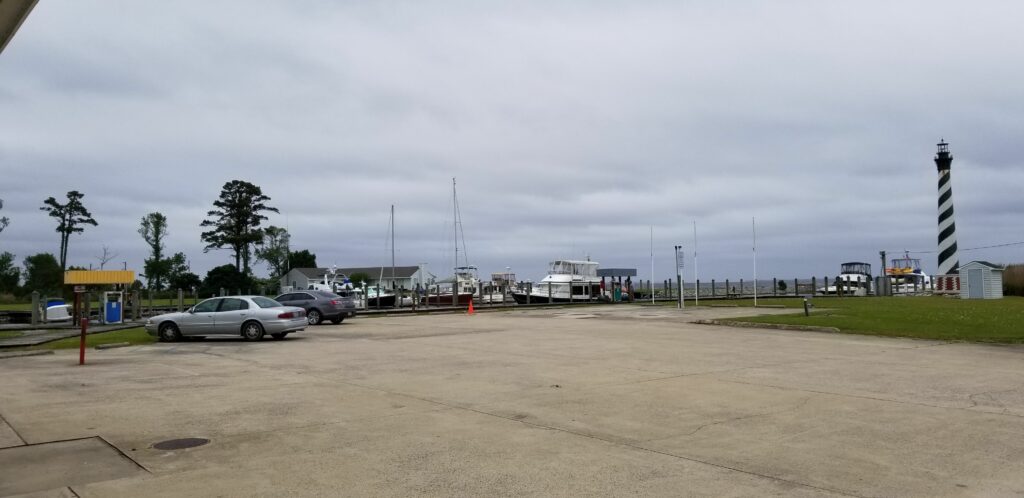
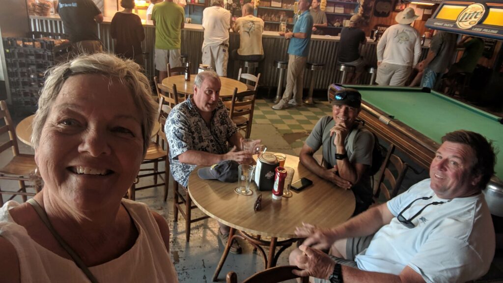
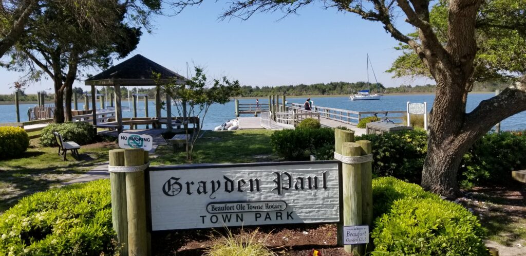
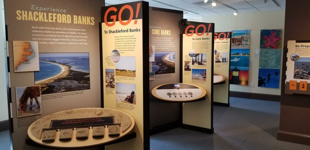
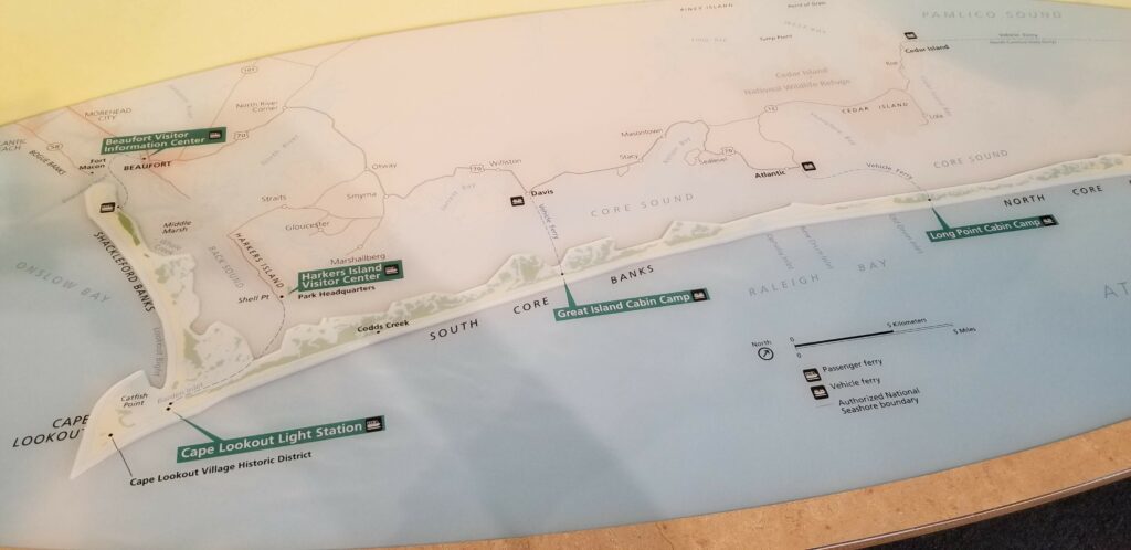
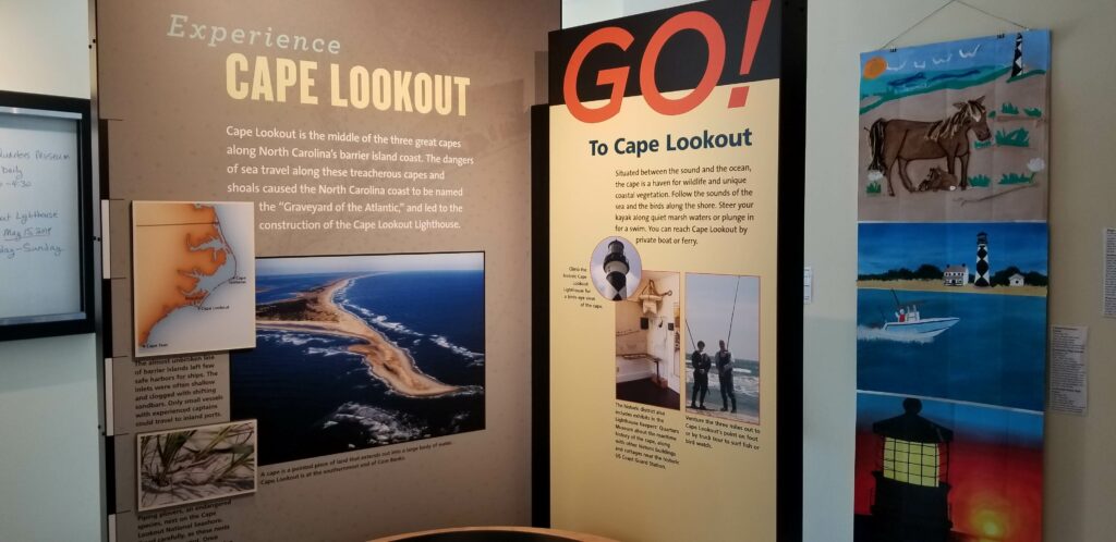
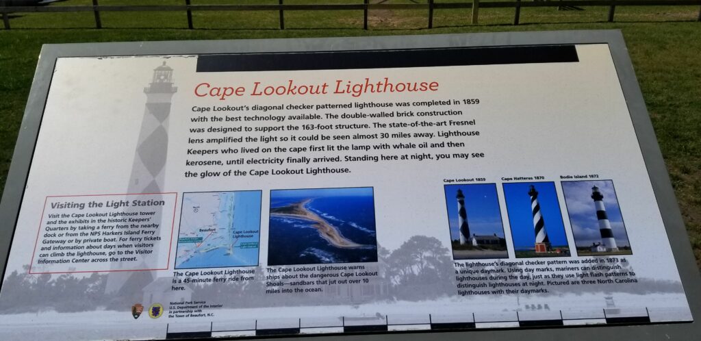
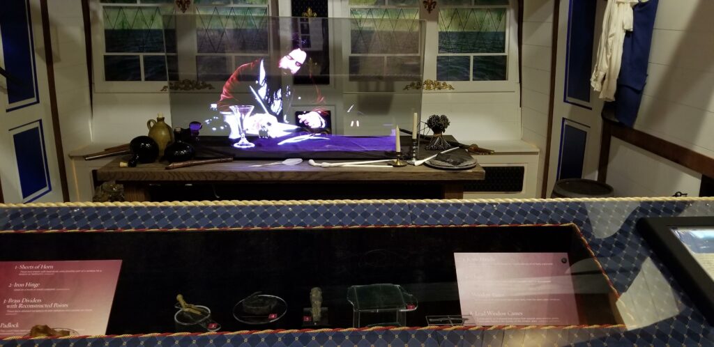
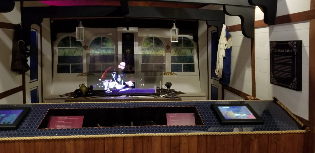
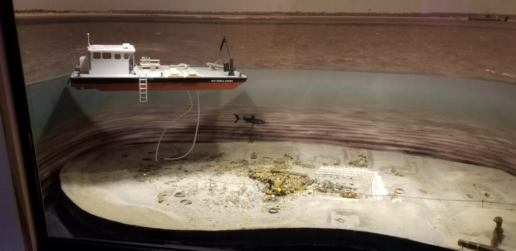
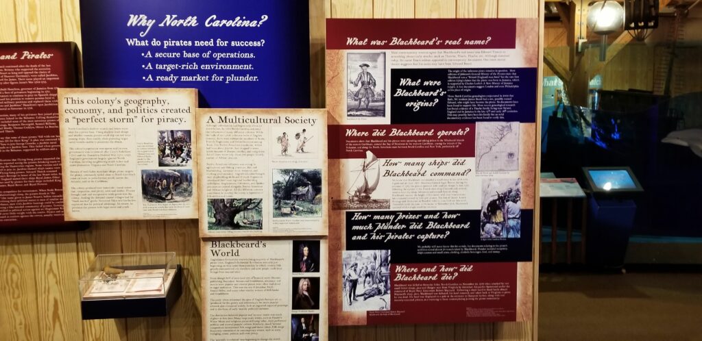
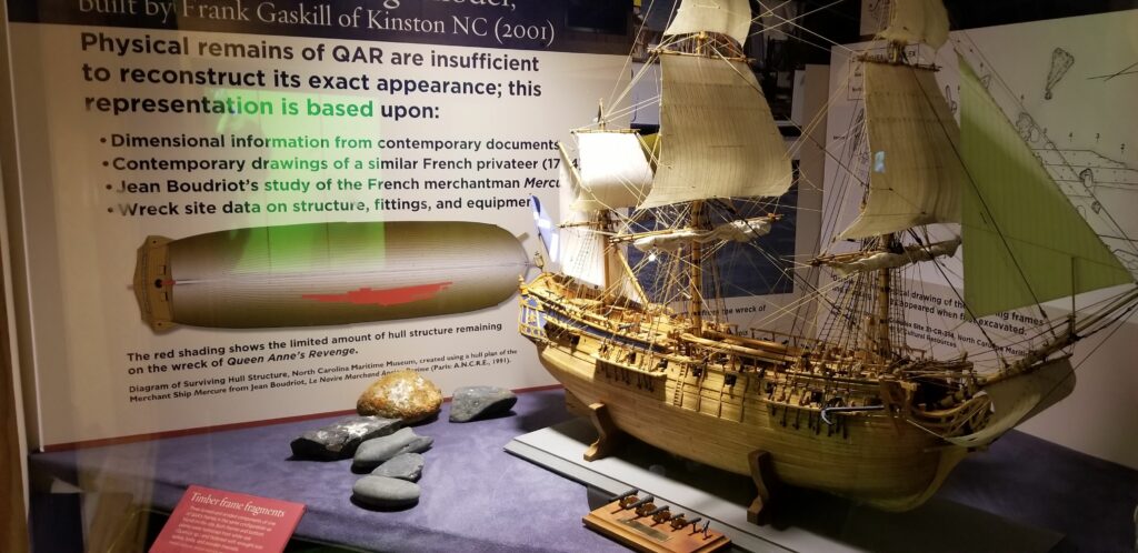
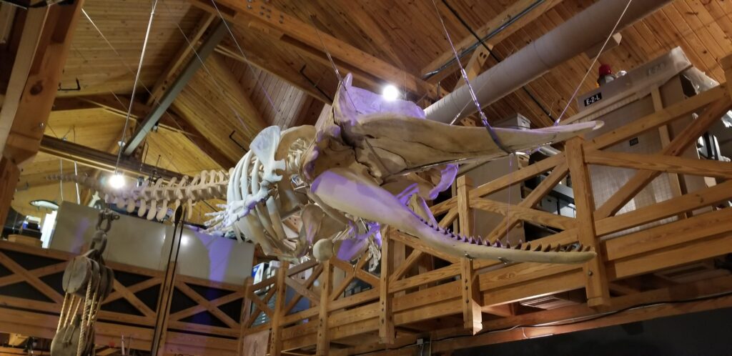
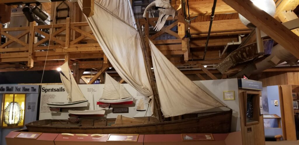
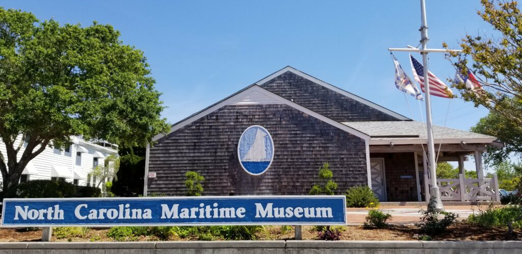
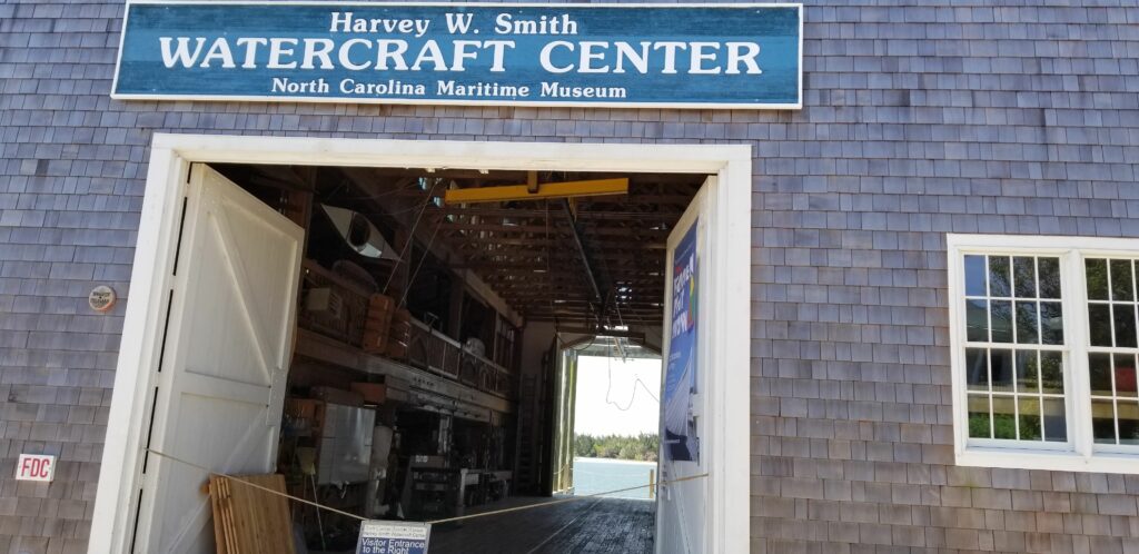
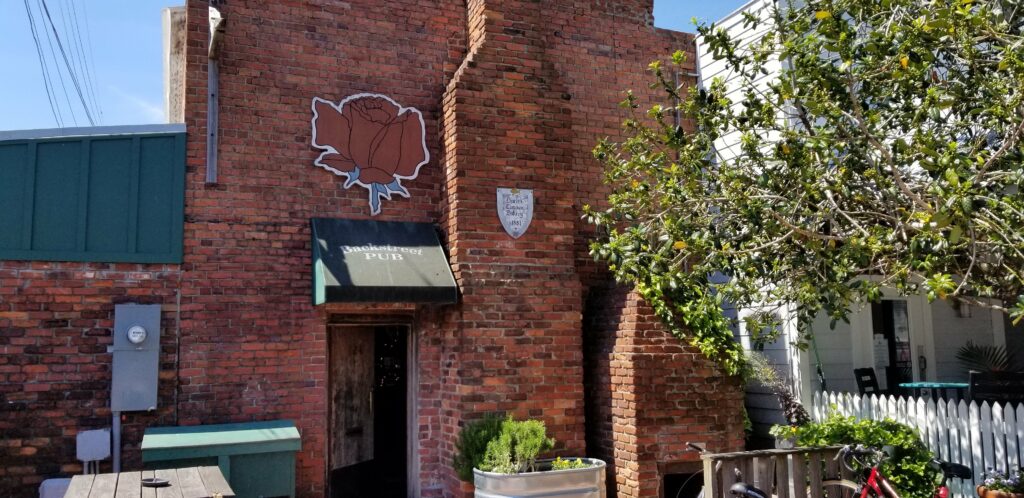
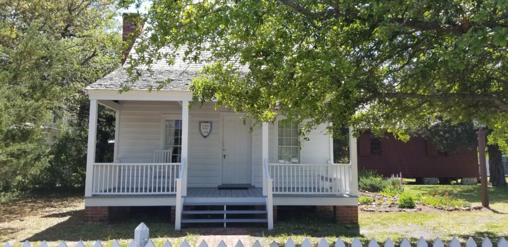
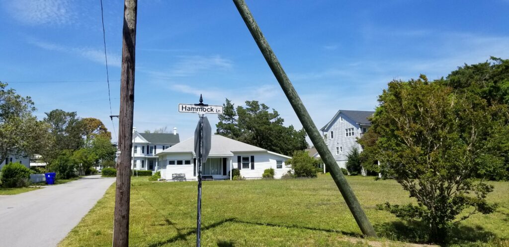
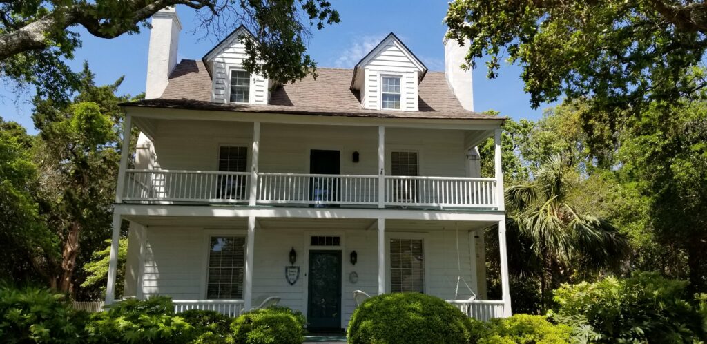
Started the day touring the town – if I come back here, I would anchor out and use this park’s dinghy dock, nice place.Went to the North Carolina State Parks area exhibit – they have wild horses here too.Lots of State parks and history in this area… Lookout Point in particular.Actually – Cape Lookout, lots of wrecks here because of the point of land sticking out into the ocean.Right across from Front Street is and Equestrian Preserve and park.I could have taken a ferry to Cape Lookout, but there is plenty to see here. Interesting to show how the lighthouses look different.Went to the North Carolina Maritime Museum – their first attempt at life boats.The other side of the exhibit…This area is thought to be where Blackbeard hung out and lived – this is a live representation of what his cabin was like on the ship he commanded.The full view of what his cabin may have looked like on his ship.A view of the recovery vessel above the wreckage of his command ship.The history of his reasoning for being in this area.What they believe his command ship looked like based on what they found at the site.Whaling was a big industry in this area long ago – here is a skeleton…A full size replica of a local sailing vessel early in the history of this area…Street view of the North Carolina Maritime Museum.Across the street they have the Wooden Boat building center…On Google Maps, this is the house that Blackbeard lived in, in this area.Just 2 doors down, is this Pub, which is in a very old building (1881) where I was able to get local knowledge and find the actual location of the house.On the way there, I probably saw the 2nd oldest house in Beaufort (1778).But, of course, before I went there I had to have a local IPA at this place – the pub in that old building…The house is called Hammock House, and is on Hammock Lane…Here it is – the bartender at the pub told me that they have really fixed it up – when he was young, it was abandoned and the kids would dare each other to stay the night there – supposedly haunted…Something I noticed as I rode through town – most of the homes are very small.The other brewery in town – very hard to get to, and they do not sell to stores in the area.Nice place and good beer – they got the last of the keg of a great IPA, lots of yeast…Really enjoying that IPA – not clear at all, a lot of yeast.This is what is was called – really good. Met up with Bella Gatto crew at another bar with good IPAs, and $2 cheeseburgers – great way to end the day!
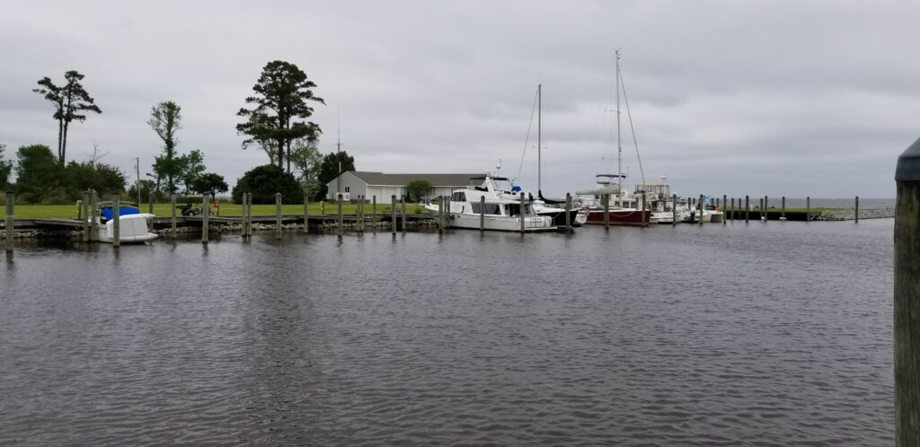
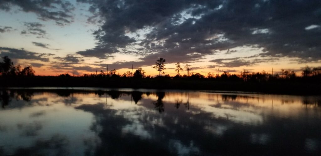
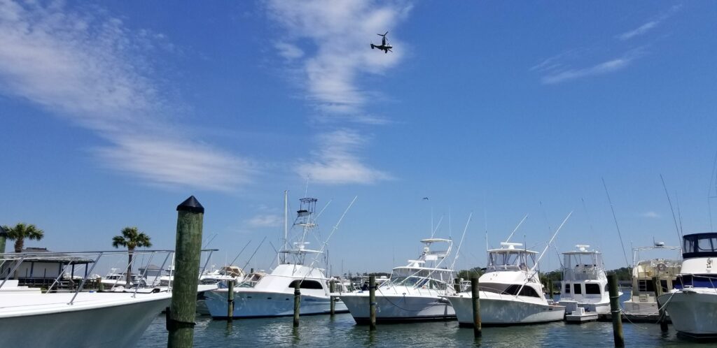
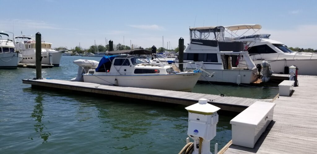
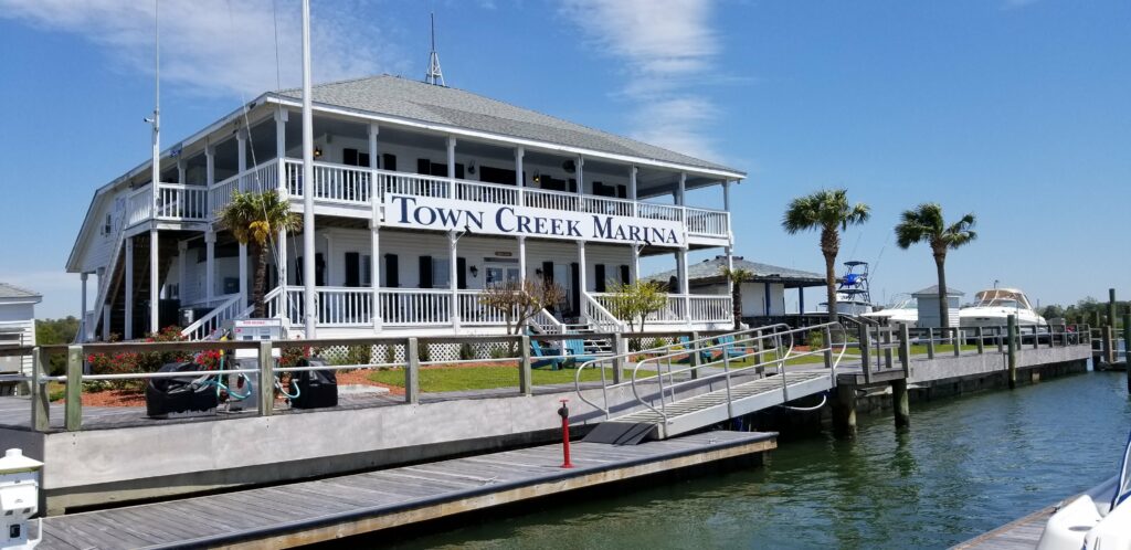
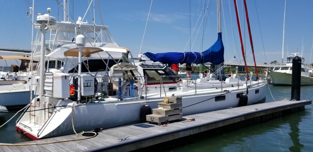
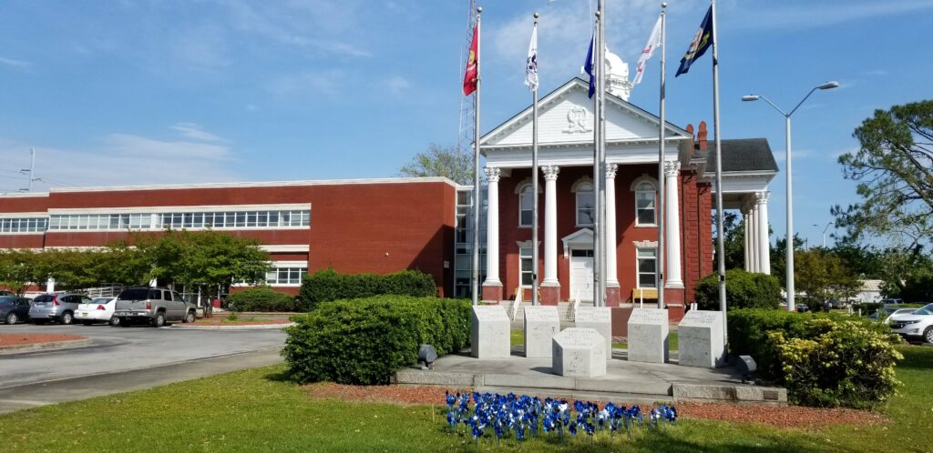
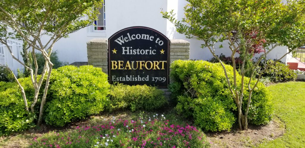
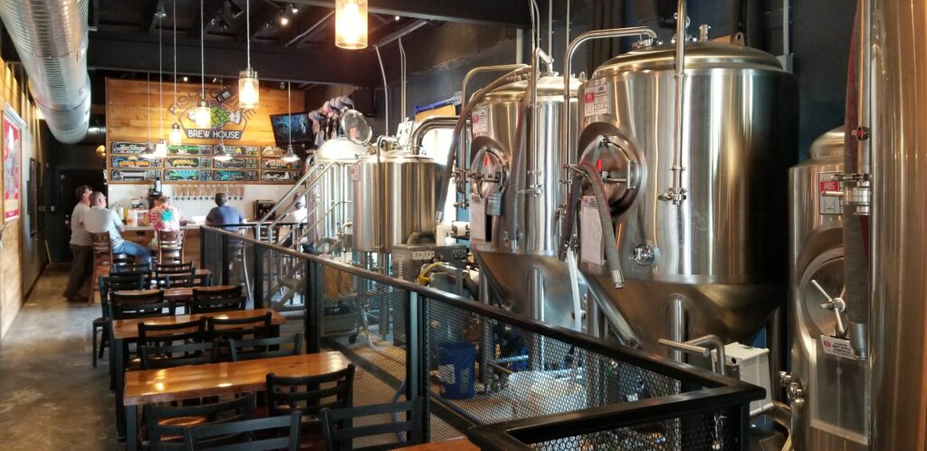
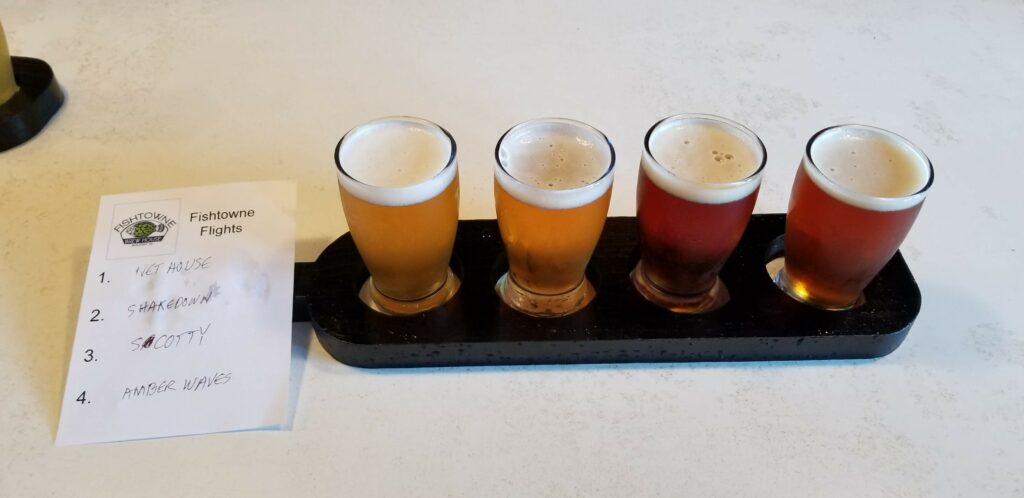
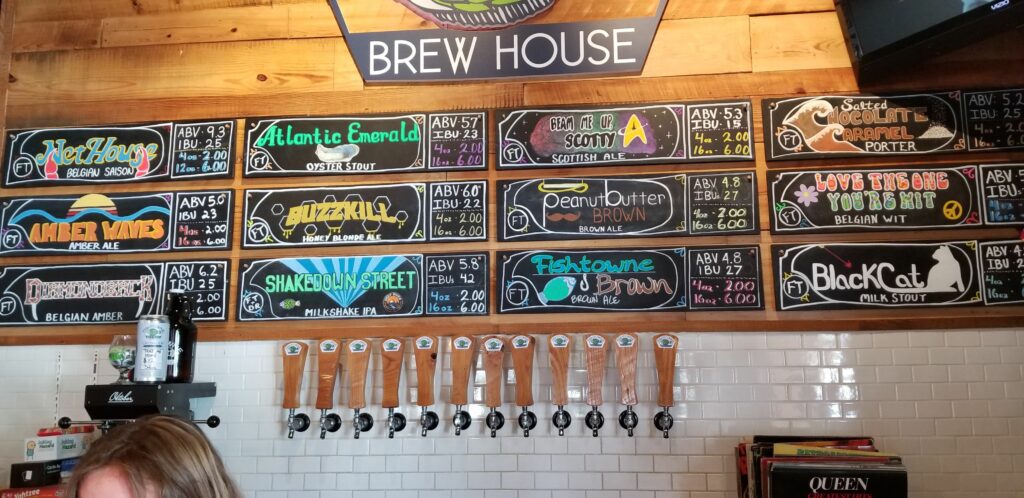
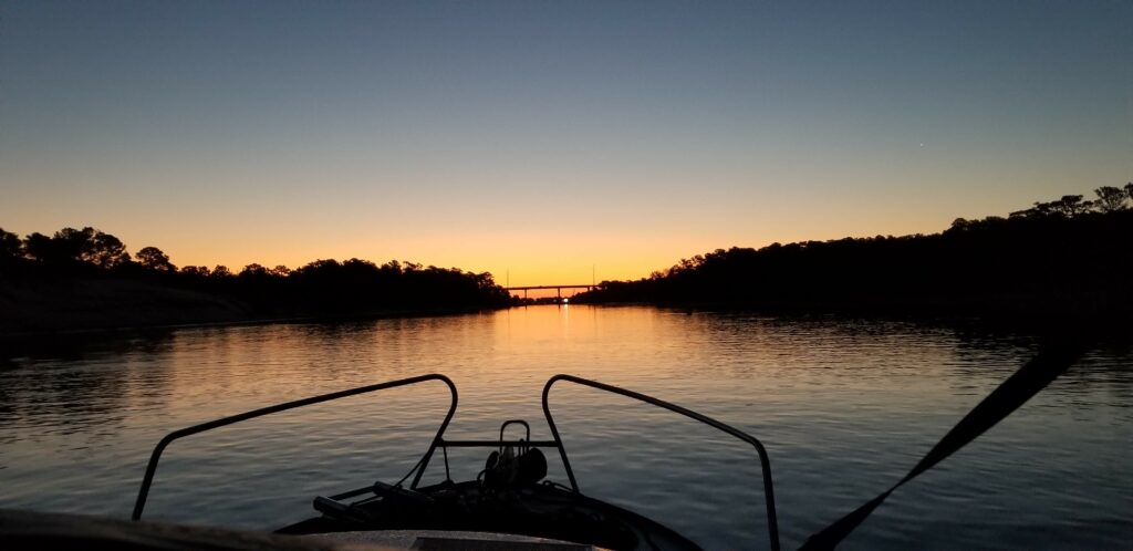
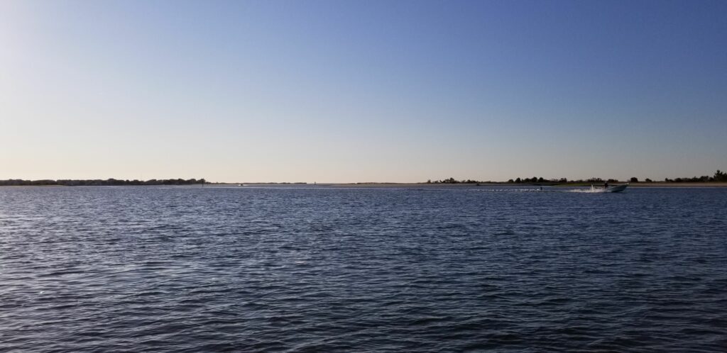
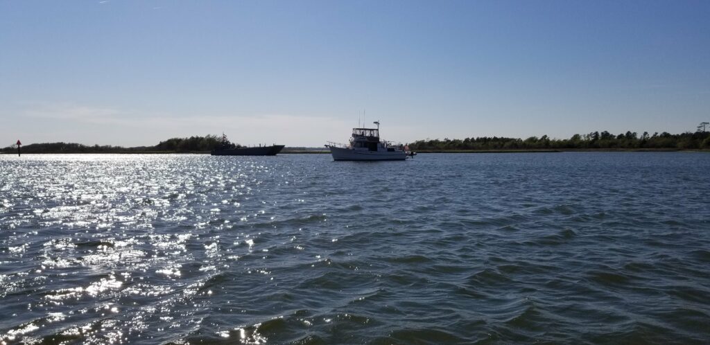
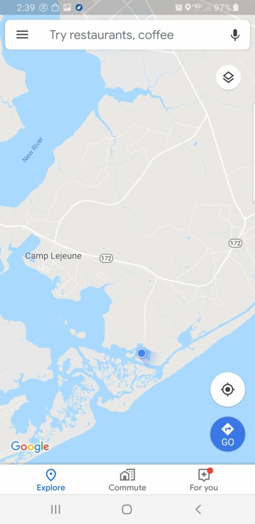
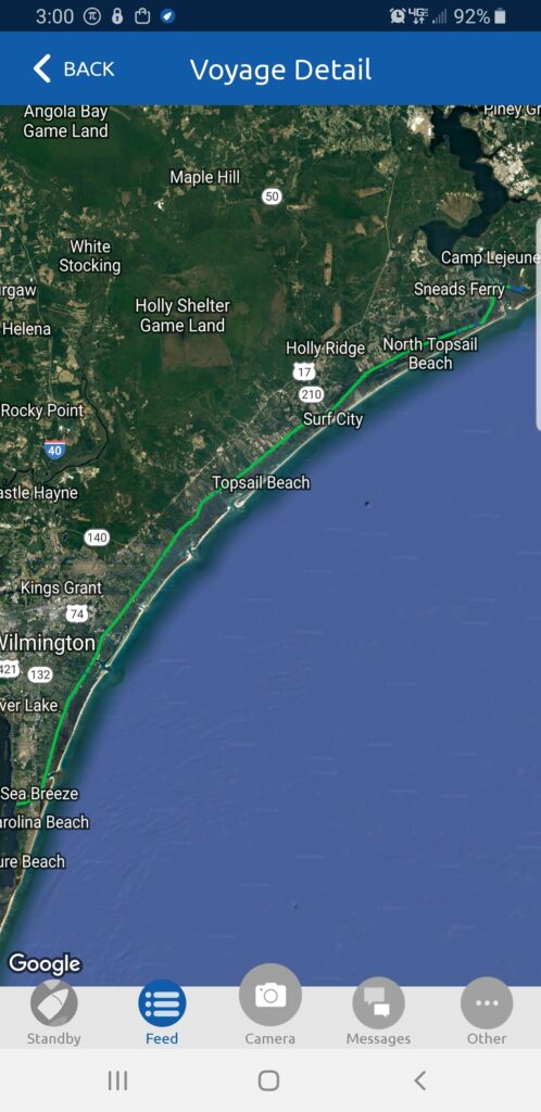
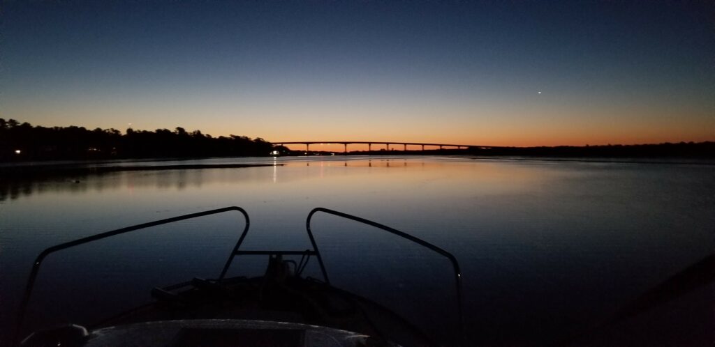
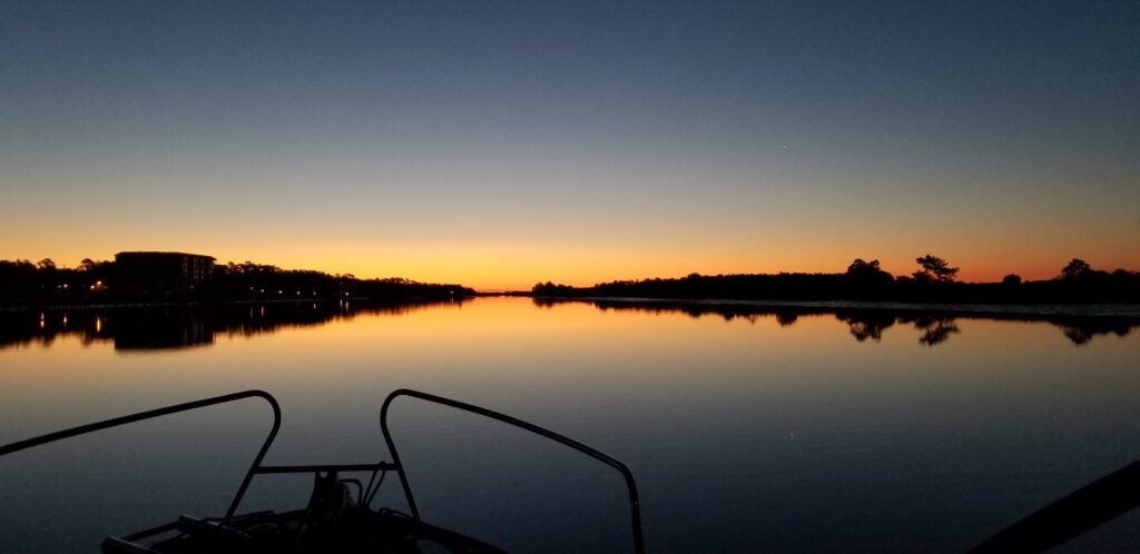
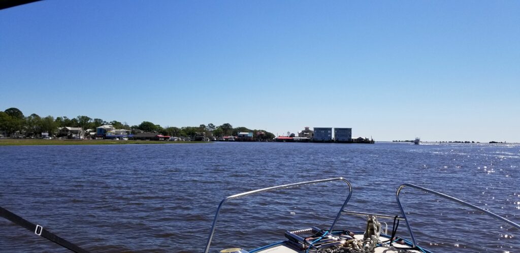
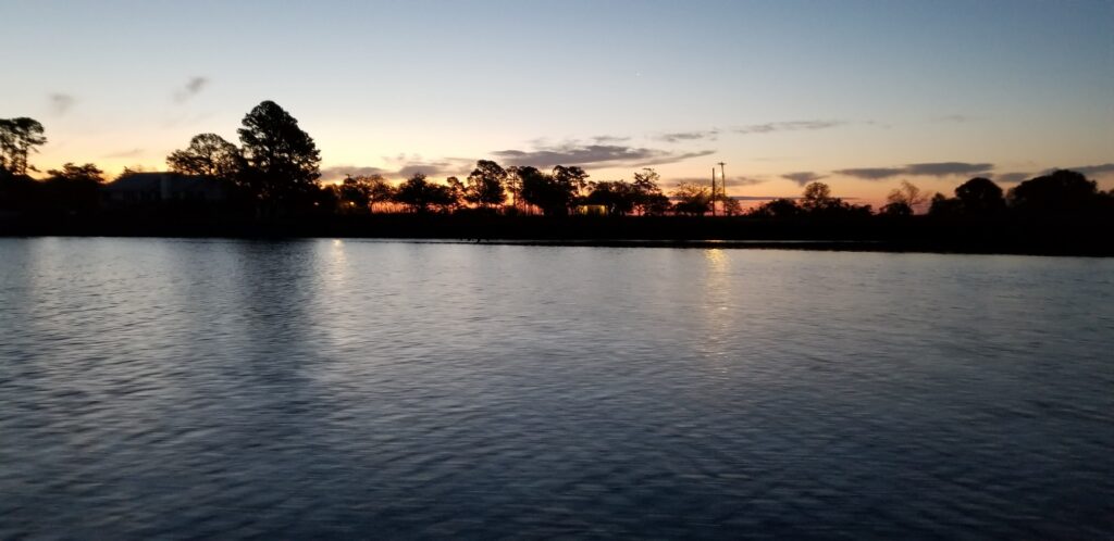
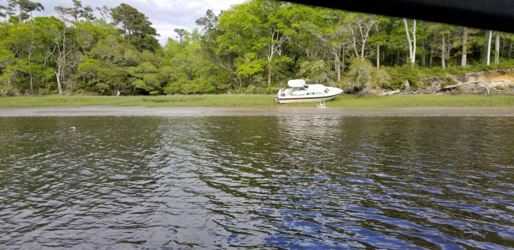
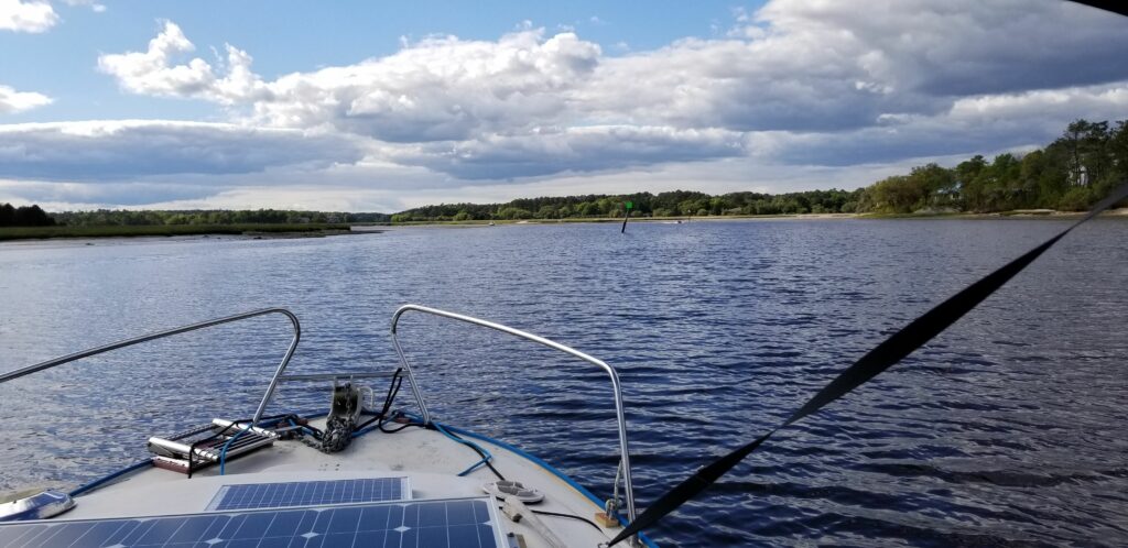
Nice sunrise – left this morning about 5:55 from the Camp Lejeune anchorage. Didn’t think I would be able to sleep well with all the noise going on, but actually did. Pulling up the anchor was messy – lots of mud, but otherwise to issue heading out.The first inlet I passed – up til this point, the current with assisting me, but after this point it was mostly against me.A US Army LST heading my way – probably back to Camp Lejeune.Two out of three of the LSTs that landed here during the night were able to leave – this one appears to have misjudged the tide and is high and dry.This was a large inlet to the ocean which was causing much of the current that was against me as I approached. I had hoped for an assist as I left it, but very soon after was Bogue Sound – a large body of water which spread out the water that would have sped me on my way.This is the beginning of Bogue Sound – more than 10 miles long, and the wind was building from the south end, where I am now.On the way up the sound, passed this large barge being pushed by a tugboat, which was hugging my side of the channel forcing me into shallower water – he had to do that because of the wind direction.In the distance (a little over 10 miles away) you can see the bridge that I pass under to get to the Morehead City/Beaufort area.You can see the fetch that allows the 15 mph wind to build some decent sized waves.A little rough at this point – the boat is rolling back and forth in the wave troughs, meaning that I constantly have to put input into the steering wheel. This went on for over two hours and was a little uncomfortable.Finally got through the bridge and am now approaching an area of the Intracoastal near the inlet at Beaufort which is local knowledge only – no charted path to get to my marina. It was a little unnerving, but worked out ok after I had seen several local traverse it as I approached.Made it through that area not problem, now following the tour boat.Approaching Town Creek Marina – had to wait for another boat to dock before me.Just after I docked, a V22 Osprey flew over!Great dock spot. And a small world story. The boat docked next to me is for sale – it is a 34 foot Mainship Tralwer, one of the types of boat I had been interested in to do the Loop. After I docked, the owner came over, and introduced himself. During our conversation, it turned out that he and his wife had come to see Catitude a couple of months ago to consider buying it!The marina office – a restaurant/bar is on the second floor.I saw this sailboat at the dock near me and had to go check it out. The couple that own it are going to sail it around the world.I got the folding bike out and rode to the local Piggly Wiggly and did some shopping – 10 cans of tuna, sweet relish, and I splurged and got some chocolate chip cookies so I can have desert now and then. After the shopping trip, took the bike to town, which was over this bridge. The marina is between this bridge and the tall bridge in the background.The County Courthouse.And I am welcomed to Beaufort NC – the third oldest city on North Carolina. Georgetown, a few days ago, was the third oldest city in South Carolina.Found the brewery in downtown Beaufort – nice little place.They had a special on a flight of beers – there are my selections.And here is the beer menu.My route for the day. I am staying here tomorrow as well to see the crew of Bella Gatto, then I will head to either Oriental or Belhaven NC.
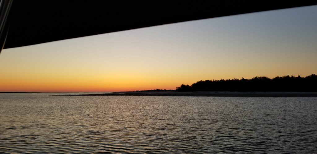
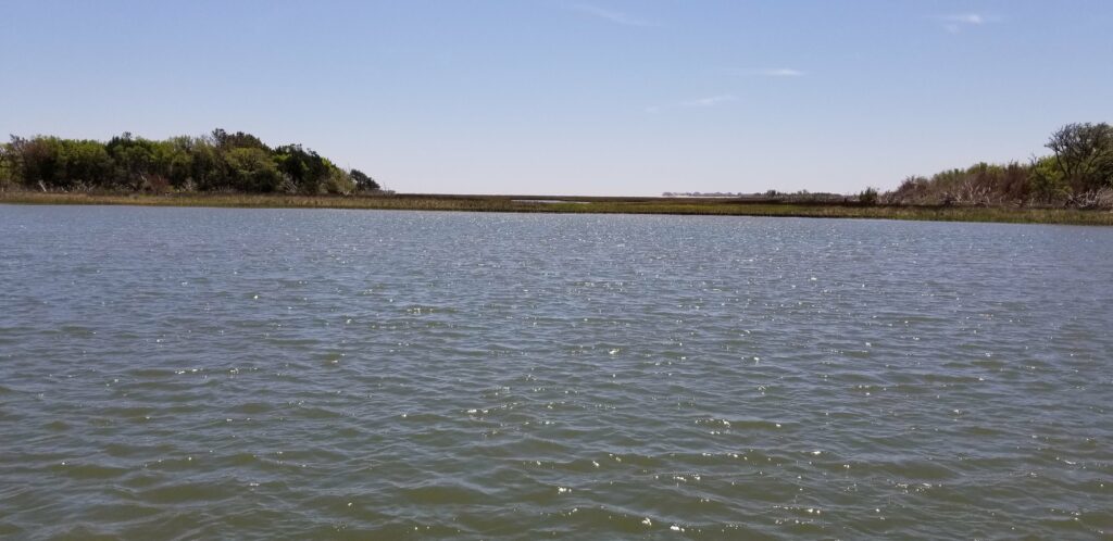
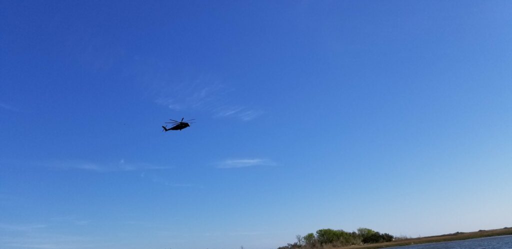
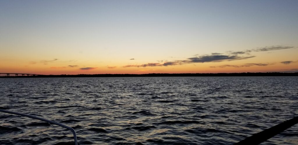
A beautiful sunrise to greet me doing down Snow’s Cut from the campground. Left at 6:00 AM this morning.The first inlet I came to had a nice sunrise also – the current was still with me at this point. There were several inlets I passed on today’s journey.The second inlet – like yesterday, as I approached the inlets the current was against me but as I passed them I was aided by the current.Passing the bridge at Wrightsville NC – originally this was to be today’s stop, but I made such good progress yesterday, I could continue on to the New River Inlet anchorage.A dredge partially in the channel working on the areas that are shoaling in.Another inlet, just about to get the current assist…It was a really beautiful calm day for the most part – warmed up from 55 degrees this morning to 75 here.The next inlet – you can see the ocean waves out there.Another example of the difference in chartplotters – the Garmin shows I just left land, and Navionics shows me in the channel with plenty of depth.Through the opening here, I could see the ocean waves breaking far away probably on the beach.Before I got to the anchorage I had to negotiate the New River Inlet opening. This has has some bad shoaling, so the channel is moving around all the time. Last year when I came through with Catitude, I ended up in less than 4 feet of water for a short time – kind of scary. This time, I had some prior knowledge and knew what to expect, so it was not bad. But, you can see that the path through the inlet does not necessarily follow the markers – I had good water all the way through it.Approaching the anchorage for the day – never been here before, but it looks good. I made really good time today – the current was mostly in my favor. I average about 7 mph – doesn’t sound like much, but the boat cruises at 6.5 mph and it takes time to leave the morning marina slowly and enter the evening destination slowly as well.A view of the boat behind me in the anchorage, and the shore of Camp Lejeune – lots of action over there.Another trawler joined us, and in the background you can see one of the many military watercraft going in and out of this harbor. That is a landing craft. Several of those came through.This big helicopter was flying around, and I later saw it flying with a huge load suspended below it while it flew over the anchorage.This is where we are at Camp Lejeune – I can hear lots of target practice going on inland with large ordinance (not here, or they would make us leave)…My journey today – a little over 52 miles in 7.5 hours. Tomorrow I will be in Beaufort NC/Morehead City. In 8 days or less, I should be in Norfolk, getting ready to traverse Chesapeake Bay.
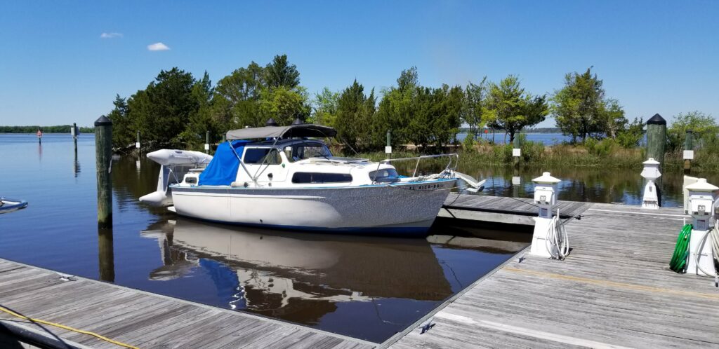
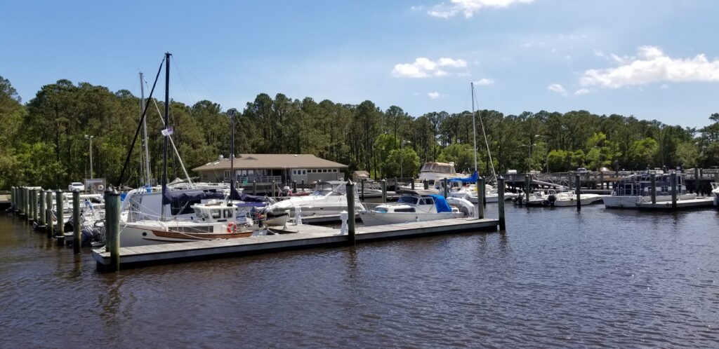
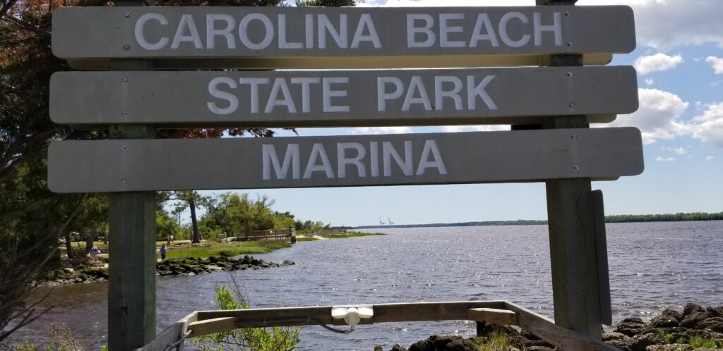
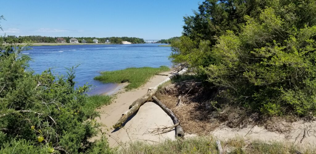
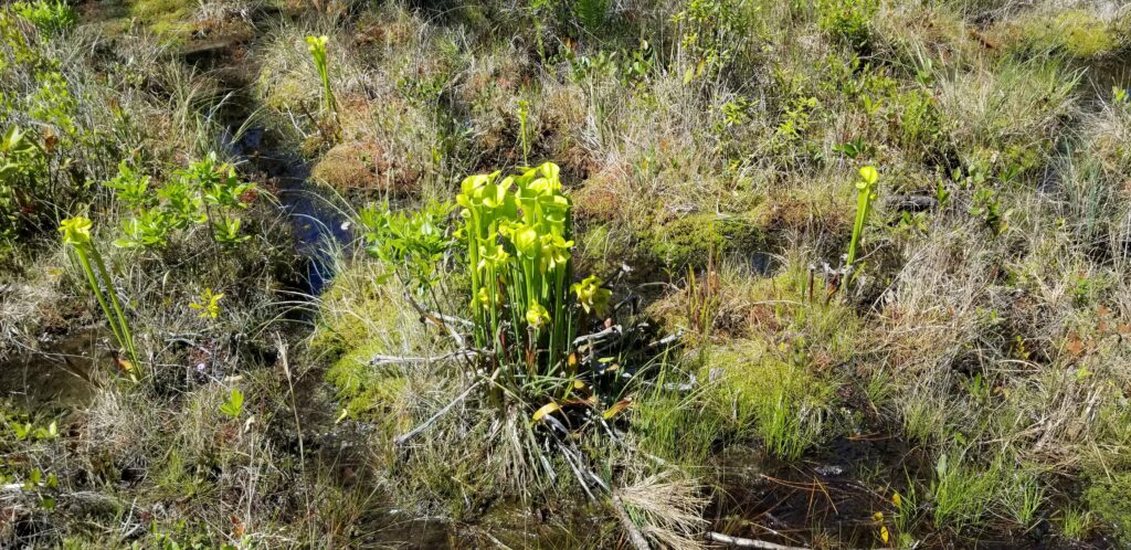
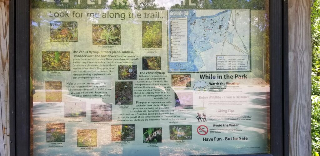
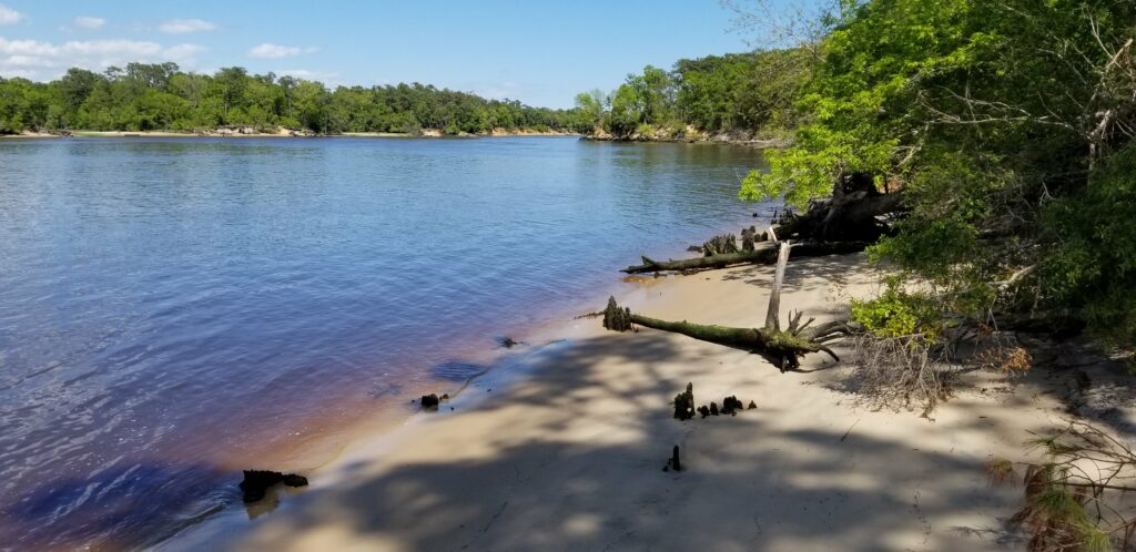
Based on the advice I got from the crew of Bella Gatto, I researched the tides for Southport, where the Cape Fear River inlet is, and determined that I had to reach that point by 10:55 AM – so I set my alarm for 5:00 AM, and left my anchorage by 5:20. This is my first view of the sunrise.And it got much nicer – 48 degrees out makes for a clear morning, also very calm.Coming up on another bridge with the sunrise still occurring – at this point I could see pretty well.I passed two inlets to the ocean on the way to Southport – this was one of them. Each time I was approaching one, the current was against me, but as soon as I passed it the current was with me about half way to the next one.This is the second inlet I passed on the way to Southport – here after passing it I got an assist from the current til about halfway to Southport, and then it was against me til I got there (although I new then that I would have an assist up the Cape Fear River).I was able to reach Southport by 10:30 and just caught the end of a rising tide This is Southport – when I brought Catitude home last year, I stopped here and enjoyed the place. Since I had already been there, I decided to skip it and take the favorable conditions up the my next destination…The Cape Fear River inlet – looks rough out there, glad that’s not the way I am headed. I am turning North, up the river. . At this point heading north up the Cape Fear River, I was going 10.0 mph over the ground! Huge assist from the last of the rising tide.This is a wide river – if it was windy, this would be rough, but as you can see, it it relatively calm and a beautiful day. I reached the Carolina Beach State Park marina (also part of the advice from Bella Gatto) around 12:20, making this a 7 hour day. This is the entrance channel, at the beginning of Snow’s Cut where the Intracoastal leaves the Cape Fear River. What a great place! Very well protected – I have my own slip.The entrance and Snow’s Cut are behind me and on the other side of the trees.The marina and marina office – the cost of the slip was very reasonable and included power. Not that I really need it, but I went ahead and made my tea and heated some soup for lunch using there power 🙂The marina sign, and through you can see the Cape Fear River.The view down Snow’s Cut, which I will be traversing tomorrow on my journey.The trails here are really nice. I walked about 3 miles of them. This trail is the Flytrap trail, where there are supposed to be Venus Flytraps. I didn’t see any, but I saw the interesting pitcher plant.The trail map and some of the plants that are in the park.Another view of Snow’s Cut from the Snow’s Cut trail at the park.This was my route today – about 54 miles in 7 hours – good day.
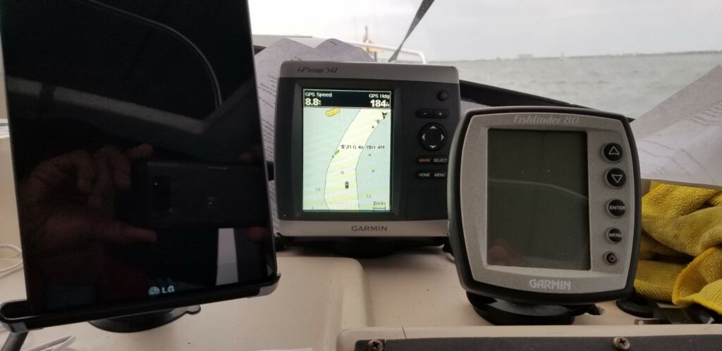
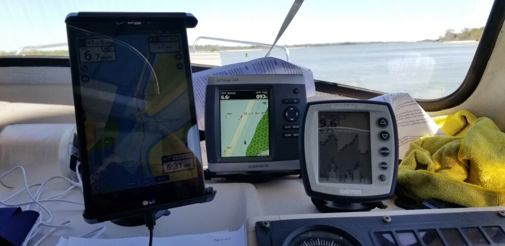
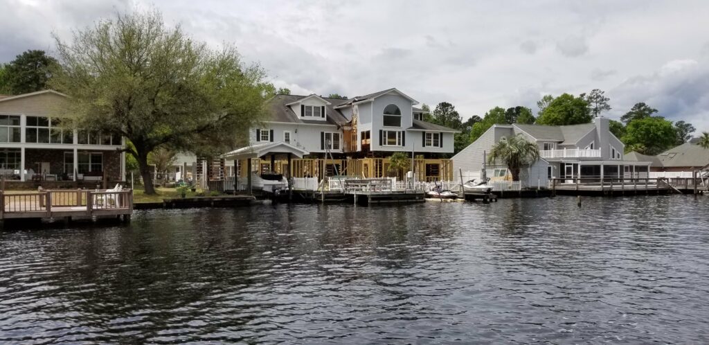
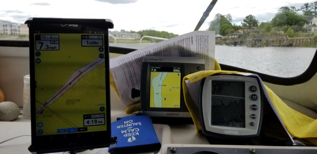
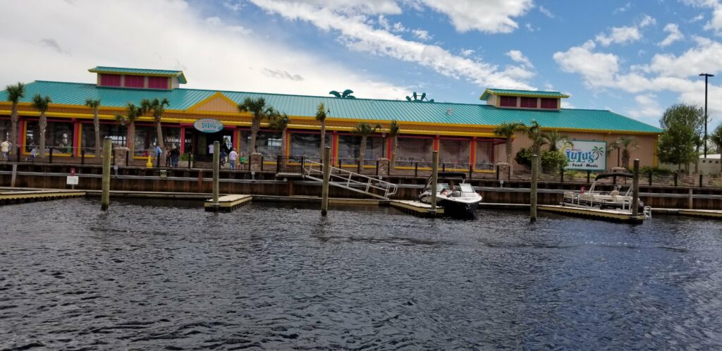
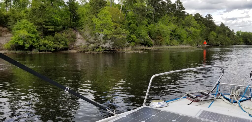
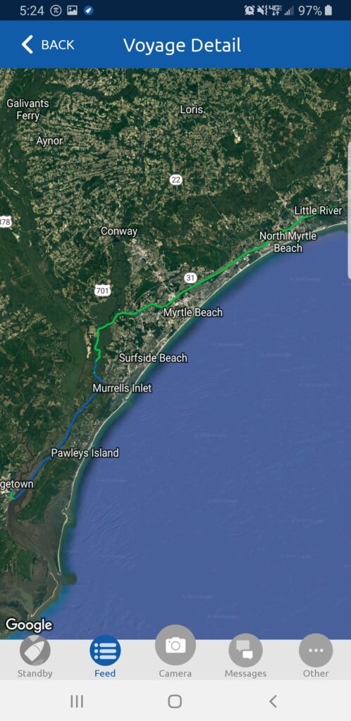
Sunrise as I am leaving Georgetown South Carolina.And it got better – good thing because the current was against me for the next 4.5 hours.Heading up the Waccamaw RIver doing about 4.5 mph. Also, it was 45 degrees so I was really bundled up!Lots of traffic at one point – a powerboat passing two sailboats which are in the process of passing me.Until the wind was against them, the sailboats were motor-sailing and making good time.Really beautiful out here – parts of this looked like the St Johns River.Well now I know that my boat will clear an 8 foot bridge – just went through the one behind me and it was close! The charts show that there is 11 feet under the bridge – so I was surprised to see the board showing just at 8 feet.I had seen this arrangement under a house earlier in my trip, but today I saw it twice and it looked like they had raised the house with those supports, and then were building additional space underneath it.Here is another example of different chartplotter companies showing opposing views of the channel. The Navionics one (large tablet) shows that I directly in the middle of the channel, while my Garmin shows that I am on land. You can see that I have plenty of depth beneath me.This is Lulu’s – she is Jimmy Buffett’s sister and has several restaurants. This one is in Myrtle Beach and the free dock I might have stayed at tonight is in front of it. Unfortunately, the free dock is only a day dock – no overnight stays allowed. So, I kept going – but at this point, the current had changed in my favor and at times I was going over 9 mph. So, it was good to go on to the Calabash Anchorage which was about 13 miles further and try out my new anchoring setup.This is part of the famous (or infamous) ‘Rockpile’ on the Intracoastal that can be a little worrisome. The channel is narrower than the minimum that was intended for the Intracoastal because the rocks were so hard to dig through.It is intimidating to go through here – especially at low tide when the rocks seem very close. The nice thing is that just after the rocks it get deep fast, and so the actual channel (as long as you stay in it) has plenty of depth. I heard a boat calling Sea Tow around this time, and then saw them about a mile later – apparently on the rocks. They were stuck and waiting for assistance. I was surprised at how long and at times narrow the Rockpile was – when I brought Catitude through last year it must have been higher tide, and I was going faster.I made it under this bridge also – charts showed 9 feet, but the tide was low and the actual clearance on the board was 11 feet, so no sweat.This is where I am anchored for the evening – very close to the shore, but it is already low tide and I am in 6 feet of water, so I’m safe. That guy over there either misjudged, or his anchor dragged.My view up the Calabash River – very peaceful here, and my anchor setup is working great! Took a little finagling, but finally got it set with the bridle correctly.Here was my route today – 63 miles in about 10.5 hours, a good day! I heard from the Bella Gatto crew after I anchored and they gave me the skinny on the potential issues in my upcoming day, and they found a great place to stay – I will probably stay there tomorrow night. Thanks guys!