Nice clear cold (53 degrees) final day in Georgetown SC – I have really enjoyed it here, the town, the marina, the boating friends…Early on a Saturday morning, the town is clear and quiet – although later it certainly livened up. This apparently is a destination for many people on the weekends.While I was walking down the boardwalk along the water, I saw this C Dory – very much like the one I have that I had considered doing this trip with. These people are doing the loop as well – even though this is just a 23 foot boat, it certainly cost them 60-90,000 dollars, more than 10 times what my boat is worth.I spent a lot of time in the Maritime Museum today – lots of boating history in this area.The Henrietta – a very famous ship built in this area in 1874. Today was a relatively lazy day for me waiting for the wind to die down so I can resume my trip. Winds today were 25 mph for much of the day and cold. I walked through the town several times (over 11000 steps), and read a book in the marina lounge. Also pretty much all prepared to shove off early tomorrow morning, when it is supposed to be 48 degrees – Brrrrr!
The day started off windy and blustery. As the day went on the wind got stronger and it rained very hard at times – turns out I fixed one of the leaks from rain in my boat though 🙂And here comes more rain…Lots of rain – glad I’m not on the boat right now.Its getting windier – already 37mph gusts. The worst part of the storm is supposed to hit in about an hour.This has been my ‘office’ for much of the day – planning the next few days journey and staying out of the storm and rain. Plus I can see my boat and the boat next to me from here. I have a video to add (still processing) just before the storm hit. When it did hit, gusts were over 40 mph, but luckily didn’t last very long. Still blowing out there, but looking better for 2 days from now when I leave for my next destination.The Albin was rocking and rolling even before the worst of the storm, but the extra lines I added (blue) really helped. Here, the wind is blowing about 25 and gusting to 37. When the storm hit, I almost couldn’t see the boat through the rain and wind-driven water.
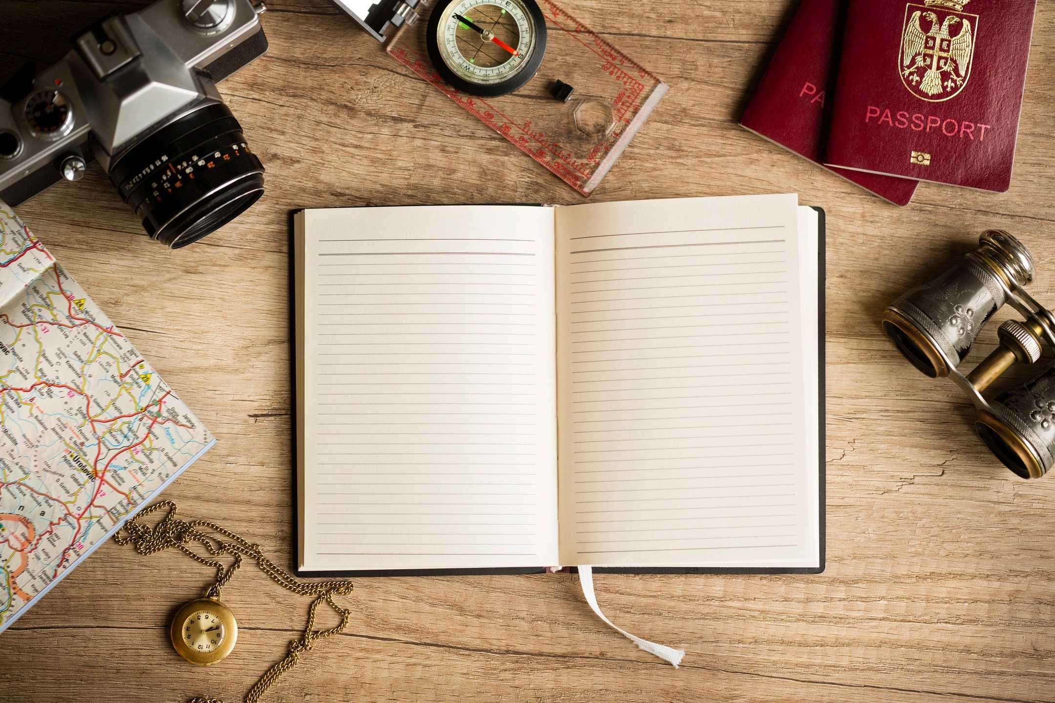
Beautiful sunrise – left really early this morning, 6:10 AM. Wanted to get to Georgetown before the wind kicked up.Got boarded by the Coast Guard at 6:30 – they were concerned that I did not have my running lights on, although you can see it was light enough to see pretty well. They did a full safety inspection, which I passed – and got a ‘free pass’ in case I get stopped again.After the boarding, the sunset was even better…Crossing the Santee River – beautiful day, a little cool early on, but much warmer later.Came upon a floating swing bridge – never seen one before.Here is the actual bridge – it is a long barge that swings to the other shore and cars can drive across.Made it to the Georgetown Harborwalk Marina before 11AM – great place.This is the lounge, showers, laundry facility – very nice.Amazing spot – walk out of the marina and I am on Front street, with tons of restaurants and bars within walking distance.Theaters, restaurants and bars on both sides of the street.The free Maritime museum.A famous ship sunk during the Civil War.The smokestack can still be seen sticking out of the water nearby.Great spot – everything is right here.Made an anchor bridle system for the boat.Strong stainless U-bolts bolted into the hull with plates on both sides and set at the height of the rubber rail – so no chafe. Also very large strong line.And a fitting that will connect to the last link of my 65 foot chain.Buzz’s Roost – nice Terrapin POG IPA, overlooking the water along the Harbor Walk.And then a $2 Founders All-Day IPA – they are giving them away…The boardwalk along the water where most of the restaurants and bars are – our marina is just down the way.Dinner out with a bunch of my cruising friends – really great group. The next two days are forecast to be pretty bad weather – especially tomorrow, so I am not leaving until Sunday morning. Not a bad place to be stuck for a little while…
No sunrise picture this morning. Even though I saw it at the end of the dock, I was already thinking of leaving today to head partway to Georgetown. I had seen a lot of the city and enjoyed it, and I didn’t want to have to do the 12 hours to Georgetown all in one day, in potentially rough weather. I had intended to do some work on the boat, and then leave in the afternoon, but my new friend Don on the all wood huge motor yacht behind me at the dock convinced me that I should go immediately and not wait. Before I left, I borrowed his Sawsall to cut a couple of small pieces of wood off of the base of my fuel transfer setup for an anchor bridle I have in mind. This picture is looking out the back of the boat at the Charleston City Marina as I am leaving it.This is the main reason my friend Don said I should go immediately – look how calm it is, and this is at 8:30 in the morning.My last view of the beautiful huge bridge to Charleston.And the old fort that guarded the city at the end of the bay just inside the inlet from the ocean.This is the marina I stayed at near Charleston when I brought Catitude Home – Tolers Cove.One of the inlets I passed on the way to McClellanville. Every time I passed an inlet, the current changed – sometimes in my favor, but usually not.Not only was it low tide, but the Intracoastal in this area is very shallow and narrow – a few moments inattention and a boat can go aground. On the way here, I passed a dredge which was deepening the channel, but at the time was directly in the middle of the very narrow channel. I had to go around it, but in doing so, I went into water that was less than 3 feet deep. Luckily, I only draw 1.5 feet, so I made it ok. But everybody coming up behind me either had to wait for the dredge to move, and high tide, both of which were hours away. Today, nobody on the water way passed me 🙂 This boat coming up is at its dock and high and dry.I think the boat was made to rest on the bottom – at least I hope so.Hopefully no bow thruster, or it is full of mud.Here is an example of how close the shore is at low tide, and how much land is showing. Less than 5 feet depth for many miles here. I talked to a couple at Leland Oil who told me that they anchored for an hour just to wait for the tide to increase the depth before they could go through this stretch – part of the reason no one passed me todayHere is how narrow the Intracoastal is here – a hundred feet on either side of me I would run aground.This shows on my GPS charplotters and my depth finder how narrow and shallow it is.Made it to Leland Oil – nice dock, very laid back and inexpensive place.My boat on the floating dock – the tide is just starting to come in. The tides here are only about 6 feet – back near Beaufort they were 9 feet!And here is Adagio – happily at the dock – shrimp boat behind me, lots of that here.I got my bike out and rode through the town – really laid back with beautiful homes, all with acreage. The people are very friendly – as I rode the bike through town almost everyone either walking or in their vehicle waved at me. Turns out most of the restaurants are not open til Thursday, and the ones that are did not open until after 5, so I went to a convenience store that had a Subway, got a great Black Forest Ham foot long with a huge amount of greens on it and a Terrapin Luau POG IPA. Went across the street and had dinner under a tree.Apparently, early on in McClelanville history, they only had one school for all grades and this was it. Now it is the Middle School – they have a new High School that I did not see.And there is a lot of history here – Part 1.McClellanville History Part 2.Here is a local artist with an easel painting a picture of the bush with all of the flowers in front of her.The town sign on the way to the City Hall and the Park/Boat Ramp.The Seaman’s Memorial at the end of the part – on the Chester River.Nice City Hall.A museum and the shaft that drove several reciprocating saws powered by the wind to cut the wood they floated downstream to make lumber.My route today – I really like this Nebo App.
As an aside, I realized today that power-wise I have been totally self sufficient in that I have not hooked up to power at any marina or dock I have stayed at yet. My boat is getting over 15 mpg, and with the solar panels and engine charging of the batteries I have no need for dock power, and have only had one fuel stop in almost 500 miles. I would like to have been able to do this trip all solar, but this is pretty close to that goal. Also, my 10 gallon water tank is lasting me over a week for each fill up – very little usage of resources…
No sunrise picture today – slept in, needed 10 hours of sleep. Took the 11AM shuttle to West Marine, which was over a non-bikeable bridge and very far away.There was a Harris Teeter grocery store in the same plaza – very nice store. Also went to the Bank of America in the plaza to get some cash.After the harrowing experience of my anchor dragging in Beaufort SC, at West Marine I bought 30 feet of 3/8 chain (really big for my boat), and some shackles.At Harris Teeter, I bought a load of bread and a rotisserie chicken.Found this really great place – went there later.On Calhoun Street across from a large statue of Calhoun.This was the South Carolina Military Academy – right behind the Calhoun statue.And a big church with a tall spire next to it.Went down to the port – this was the original opening to the port.The industrial district, which they have re-purposed.The beginning of the City Market – this time I walked through the whole Market.Above the beginning of the Market is the Confederate MuseumAnother shot of the inside of the City Market.After the City Market, I went back to the Carolina Ale House – and had an IPA from a North Charleston brewery.Next, I started my Brewery tour – went to Palmetto Brewery.From the inside, you go to the actual bar.Really nice in here.Got a mango IPA – very good, not too sweet. And look at my new hat – got that at the City Market, Irish right?This is what they advertise – is it right?Next, the Revelry Brewery.Went to the upper deck – great view!What I got was the Pass the ???, a beer with real CDB – unlike the G13 which just tasted like that.There is the beer with a brochure they put out about the Charleston breweries.The view from the upper deck of the cool bridge, but from the side.Where they brew the beer.
Besides what I was able to see with the moonlight earlier, this was the first time I could actually see where I was going – at 5:18 AM. Last night didn’t turn out to be the relaxing anchoring experience I had hoped for. About 3:30 this morning, a huge prolonged gust of wind came through the anchorage. I was confident in my anchoring system, but a few minutes later was awakened by a loud call of “AHOY”! I jumped up through the front hatch and saw that my anchor was dragging through a group of sailboats. I jumped back in, started the engine, and was able to hold my position with forward gear. I ran forward again, and tried to pull up the anchor so I could move to different spot, but as I was pulling it in, it caught so well that I could not pull it any more against the over 15 mph wind and 2 knots of current – so, I let out a bunch more line, and was then sort of secure. The problem was that I was now uncomfortably close to the group of sailboats, and since my boat moves differently than they do (no keel), I was swinging too close to them at times. Realizing I was not going to be able to sleep any more, I waited for a lull in the wind (less than 15 mph), pulled up the anchor quickly, and went ahead and started my trip for the day at 4:15 in the morning.The next few photos are the sunrise progressing as I was able to see better and better and realize how rough it was!Brighter – I can now make out the number boards as I pass them.The sunrise doesn’t seem as impressive, but I can see the water really well now.Just as the sun was coming up…Pretty rolly – the boat was wallowing, but moving along nicely.About 7:30 in the morning, I passed the stop I was intending to make for the day, but because it was so early, I decided to go ahead and go all the way to Charleston (turned out to be an 11 hour journey).More whitecaps, but the sun is out – oh also, it was 59 degrees at this point (brrrrrr).Some pretty big waves, but the wind was mostly behind me.When the waves were not directly behind me, the boat would roll back and forth.This is ‘Side B’, the PDQ 34 Power Catamaran (very much like my PDQ 32) passing me – going 3 times my speed…Near the end of a very long passage through open water – about to turn the corner.Turning the corner was great, except I was now 45 degrees to the waves for a short time – big time rolling.Around here, it was blowing 17+ mph – you can see the whitecaps behind me.I almost couldn’t see this little cut that is the last piece of the passage for my journey. Through the first part of this little cut, I was only able to go 3.5 mph – there was so much current through there.My first view of Charleston – just on the other side of the bridge.And there it is as I am passing under the bridge.Adagio at the Charleston City Marina. The advantage to the long trip I made today is that I now get to spend 3 days in Charleston.This is the most expensive marina I have been to so far – they are charging a premium and charging me for a 30 foot boat (their minimum) when mine is only 25 feet.Some of my boating friends back home will appreciate this boat – very nice with 3 V8 automotive based outboards.As I head out of the marina, Charleston welcomes me 🙂I decided to wait until tomorrow to get my bike out since the marina offers a free shuttle service into town. While I was waiting for it, I hit the local watering hole.The view from their back deck looking at the marina.I had the shuttle take me to the Historic Downtown City Market.The French Quarter is right next to the Market.Looking down one of the streets of the French Quarter at a large church.The City Market is several buildings long.This is inside one of them.Leaving the City Market.The City Market was established in 1807.The Custom House near the waterfront on the other side of Charleston from the Marina.Lots of horse drawn carriages going up and down the streets.The first Irish Pub I came to – nice place.Some old cobblestone streets still left.The Blind Tiger was recommended to me by the shuttle bus driver.Its been around for a while…Charleston Waterfront Park.This is the first thing you see as you enter the Waterfront park – don’t know what it means, I wonder if it was the original name for the city?From the Waterfront park, you can see the old fort that guarded Charleston Harbor…And the old aircraft carrier.The pier goes out pretty far into the harbor.The last pub before I headed back to the boat.I decided to walk back to the boat instead of calling the shuttle. The beautiful old home has a grand piano in the front vestibule and really nice balconies and gardens behind the house.Really nice park with a man-made lake and path and amazing homes all around it.Sunset as I’m getting back to the marina.The blue dot is where my boat is located at the marina. Even walking to the interesting parts of town only take half an hour – by bike, it is less than 10 minutes. I’m going to see a lot more of the town tomorrow and the next day.This was my route today. I am using a new app my Great Loop friends told me about called Nebo – it does a great job of documenting the trip route.
Really nice sunrise this morning – took this one from the end of the dock my boat is tied to.A Thermacell – a flying insect repellent device, mostly for mosquitoes but seem to keep no-see-ums away as well. Tried to buy one at Walmart yesterday, but they only had the large ones – ended up getting one at the Grayco hardware store on the way back to the boat.I rode my bike a lot through town today, and decided to go to the Visitor Center first – unfortunately closed on Sunday. I guess visiting Sunday only is not recommended.Lots of history here – this is at an old church.Lots of graveyards and cemeteries and churches in town – this one is the South Carolina National Cemetery.The Marina and mooring field in the river.With the previous picture and several more that I took, my phone automatically made this panorama picture for me.Really beautiful old home across the road from the waterfront.Turns out the ‘pirate ship’ I took pictures of yesterday at the waterfront park seawall is actually a replica of the Santa Maria, just now visiting the US – pretty amazing!The Santa Maria replica from the stern – look at that rudder.I still have almost half of my Yuengling 12-pack of beer I started the trip with, but decided that I wanted to spice up my selection a little, so I rode across the bridge again and found this Sweetwater Variety Pack. I took the 12 bottles of beer out of the cardboard container and put them in my large backpack.Put on the backpack (pretty heavy), hopped on my trusty steed, rode back across the bridge to the marina, and put these in my refrigerator on the boat.After lunch on the boat, I went to the local waterfront sports bar, and had a local beer.Lots of moss-covered oaks and more old beautiful homes.Rode the bike along the river I will be traversing early tomorrow morning…And ended up going to the far side of town to a park where the road ends.On the way back from that park, I saw this house with nice-looking stairs going up to the main entrance.I ran into my friends on Bella Gatto out bike riding, and they told me about this awesome trail (Spanish Moss Trail), so I rode my bike up there to check it out.The Spanish Moss Trail was originally a railroad which connected this area to the rest of the country around the Civil War era. This is the train depot – I actually got there on Depot Road. I ended up riding about 3 miles on the trail – very nice for bike riding and walking, lots of people out doing just that.I ended up leaving the Beaufort City Marina while it was slack tide, so I could get out of there in the light. I had asked them not to put somebody directly behind me on the dock – at least leave me 10 feet, but they did not do that. A very large trawler was parked about 3 feet behind my boat and another was about 5 feet in front. Leaving at 6:15 in the morning when slack tide occurred then would have been a harrowing experience. I have anchored on the other side of the bridge – much better protected from the wind and waves, and I can now leave early in the morning without worrying about hitting someone’s boat. I’ll probably sleep better tonight anyway.
Nice sunrise to start the day. I had the folding bike out and was just about to ride to Walmart and the West Marine when the crew of two of the boat I have met and am traveling with told me they were heading out this morning for Beaufort instead of staying Savannah another day. The weather is forecast to be pretty bad for the next day, when I was planning on making the trip. So, I put the bike back on the boat, and quickly shoved off bound for Beaufort. Sorry I missed the second day of Savannah, but I have seen the historical sites several times previously, and the boardwalk on the water, whereas I have never been to Beaufort and was really looking forward to seeing it.Crossing the Savannah River – lots of current, and dolphins!Doboy Sound, the first sound I crossed today on the way to Beaufort.Leaving that sound on the way to fueling up for the first time on this trip.Leaving the fuel dock at Hilton Head Harbor Marina. I have now been able to calculate my fuel mileage, and I am getting over 15 miles to the gallon!Cape Royal Sound was the second and last sound I crossed for the day – this one was a little rough because of the ocean rollers coming in, and it is a very wide sound, so it took me a while to get across it.There is Adagio at the Beaufort City Marina dock. It is very rough and windy out there – even at the dock.The city marina office – one of the benefits of staying here is that they have a courtesy car that I can borrow for up to an hour. I chose not to – I really enjoy riding my bike every where I want to go.Like this beautiful park on the water…I really like this town – lots of places to enjoy the water view.Nice places to eat and drink overlooking the park and the water.And the requisite pirate ship along the seawall.Next street over is filled with quaint shops and restaurants/bars.Looking the other direction down the street with shops and restaurants/bars.Lots of historical homes…And churches and more homes.Got on the bike to ride to Walmart to buy extra oil filters, an oil filter wrench, some Rainx, and two types of bug repellent devices. The no-seeums, horseflies and mosquitoes are notorious in these parts. For some reason, even though my boat is not easily closed up so that no flying bugs can get in, they haven’t really bothered me that much so far on this trip. On other peoples boat though, it has been a different story.On the way back from Walmart, I couldn’t help stopping at a Taco Bell, and having some of their new offerings. Even though I know it is not good for me, I was craving a Mountain Dew, so I got that also and mixed in the Mango tea they had there as well – yummy!The bike really is amazing – I couldn’t get the huge backpack I was carrying in the picture, but with what is on the rack, it was quite a load. The bike did great – even both ways over the 65 foot bridge between Walmart and the Marina.This was my route for the day. Hung out on Bella Gatto on the way back to the boat, and made my reservations for the Charleston City Marina dock a few days from now. Tomorrow, I’ll tour more of the town with some of the crews from boats I have met in the last few days.
Overcast day to start with, but tide going my way.Now the tide is against me, but a nice sunrise is starting to appear.And it gets even better, but the calm before the storm…Lots of rain today – off and on, some of it heavy. This is after going through Hell Gate, a notorious section of the Intracoastal waterway in Georgia where the depth can get as low as 3 feet, and the current can be a bear. For me, I saw nothing worse than 5.9 feet deep, and the current was just barely against me – with me after I turned the corner from there.Believe it or not, another Albin 25 (much nicer shape than mine) I met at Kilkenny Marina last night – he is catching me as he travels at 7.5 mph to my 6.5 mph.Here hi is passing me – beautiful boat!This afternoon was set aside for chores. The combination manual pump I rode all the way to the West Marine in Brunswick and back on my bike turned out to not work very well for any purpose I intended to use it for, which was pumping out the bilge and extracting the oil in my Yanmar diesel engine. The second day of pumping the bilge, the pump stopped working, so I had to ride to River Marine Supply down the road and buy a dedicated manual (hand) bilge pump and a vacuum oil extractor. First I pumped out the bilge, which took less than 10 minutes with new small manual bilge pump – worked great, way better than the pump that died. Then it was time to change the oil. I had brought several gallons of the required engine oil and a container in which to put the used oil. The previous owner had a new oil filter already on the boat, so I used that (have to buy some new ones at Walmart tomorrow). First, the cover had to come off of the engine which required removing the seat as well. Then, the oil extractor had to be hooked up (a small hose through the dipstick tube), and with several pumps of the handle, a vacuum formed. This sucked the oil out of the crankcase very effectively. I was able to get the filter off by hand with a little grunting, and then install the new FRAM filter. I added about 3 quarts (full capacity in this small engine) to the crankcase, checked the dipstick to be sure it was full, and then cranked the engine. No issues, and I re-checked the oil level afterwards and all was good.I’m doing the laundry (must last chore for the day) while I am writing this.This was today’s route – about 32 miles in 5 hours. Even with all the rain, it was a nice trip – glad to be here. Tomorrow morning, I’ll go to West Marine and Walmart, then in the afternoon try to go down to the river downtown on the bicycle.
Leaving the marina at St Simon’s Island – using a shortcut under a 9 foot bridge, luckily my boat is only 8 feet high. There was fog this morning for about the first 2 hours. And the tide was against me most of the day – making for a very long day (59.5 miles in 10.5 hours).Went through four ‘sounds’ today, which are inlets to the ocean, and where the intracoastal crosses them. The first was Altahama Sound – a little windy, but not too bad.The next one was Doboy Sound, and again, not too bad.Then came Sapello Sound, which was a little windier and rougher, but the boat handled it well.A little further out in the sound – rougher but still good.The I got to the last sound, St Catherines Sound, and it was much windier and rough, but again the boat handled it well.Further into that sound and rougher still.Some more white water – getting on the windshield now. The boat did great! I have video I will post also, but that takes a while to load, and it is about to rain here…You can see the boat moving around and white water from the bow in the last sound.Even after the roughest part, and going with the wind after having turned the point closest to the inlet, it was rough and rolly.Had not planned it, but ended up pulling into a nice out of the way marina – Kilkenny Marina.Here it is on Waterway Guide online.Nice laid back place in the middle of nowhere…Beautiful view…This is where I had originally planned to anchor a few miles back, but wanted to get closer to Savannah, so tomorrow would not be as long a day on the water.This was a lot of my route today – you can see the last two sounds I went through.